Day 1 – Sep 19 (Seattle to Bozeman, MT to Mammoth Hot Springs. WY)
My friend Larry and I visited the two great national parks in the United States, the Yellowstone and the Grand Tetons in September 2014 to photograph the spectacular fall colors. As the schools were already open, there was very little crowd. Some of the lodges were closed for the seasons but some were closing a day or two after we departed. This blog entry shows my favorite images (along with the location info) from the terrific trip.
We flew into Bozeman, Montana on Sep 19. After picking up groceries and wine, we drove towards Mammoth Hot Springs Hotel, our stay for the first night.

We took a quick selfie after passing the Roosevelt Arch.
Nikon D610 34mm f11 1/15 ISO100
(45.028701, -110.707532)
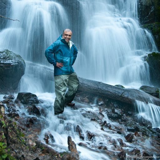
By the time we reached Mammoth Hot Springs, the sun had already set. We headed to the Devil’s Thumb & Palette Spring area to shoot a few images.
Nikon D610 78mm f11 2sec ISO100
(44.972641, -110.705331)
We checked into Mammoth Hot Springs Hotel, had a terrific dinner at the Mammoth Terrace Grill and went to bed.
Day 2 – Sep 20 (Mammoth Hot Springs to Grand Canyon of Yellowstone)
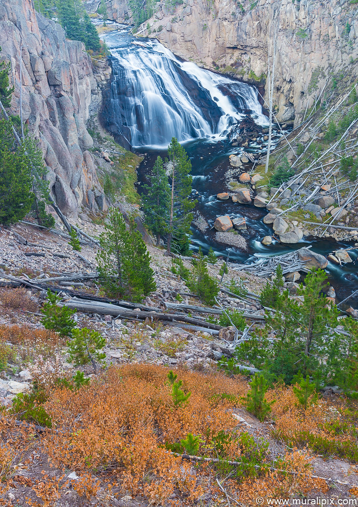
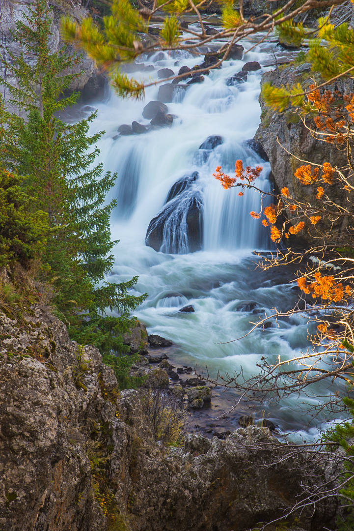
First stop of the morning was at Undine Falls. We were the first ones at the falls that morning. We took our time to capture a few images.
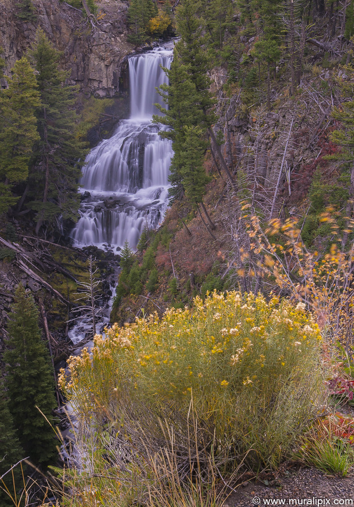
Nikon D610 62mm f16 6sec ISO400
(44.943971, -110.640132)
We continued our drive along the Grand Loop Road and the next major stop was at the Floating Island Lake. Sun was shining bright and no clouds were to be seen anywhere.
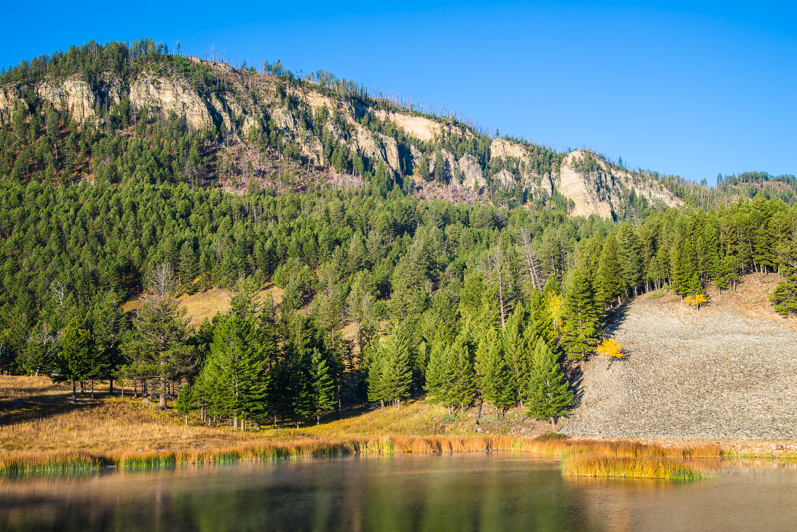
Nikon D610 46mm f10 1/50 ISO100
(44.942699, -110.449909)
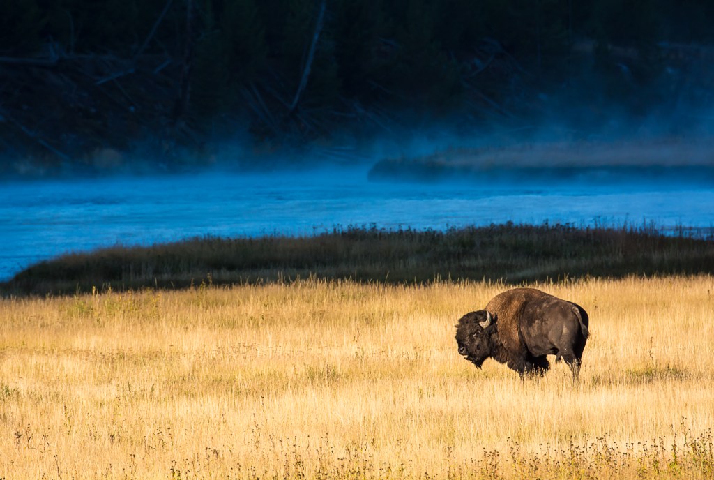
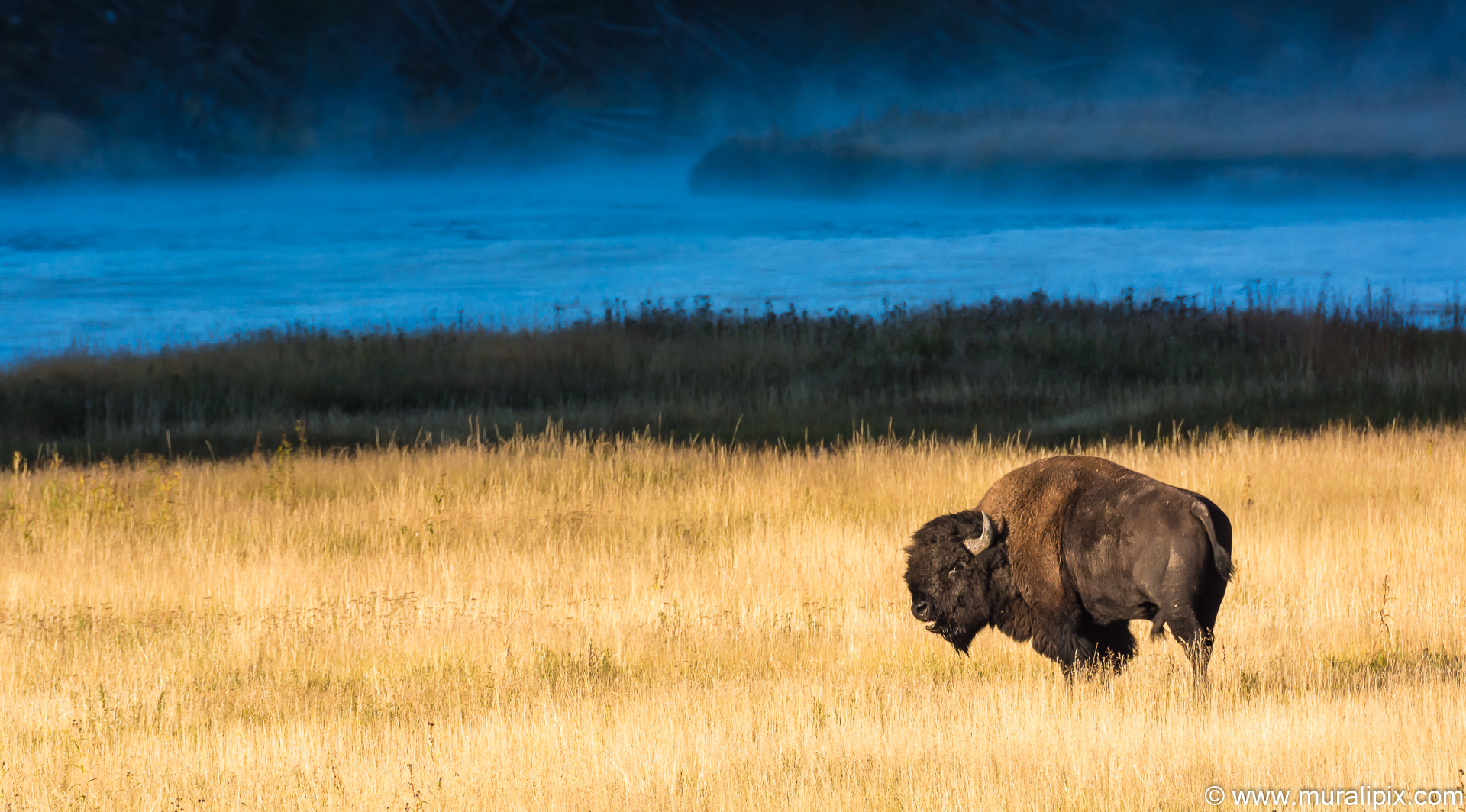
In Yellowstone, the bison is the king of the road and you don’t want to mess with them. You should stay in your car and enjoy their majestic presence. On the NE Entrance Road east of the Tower Junction, we came across large numbers of bison.

Nikon D7100 110mm f11 1/800 ISO2000
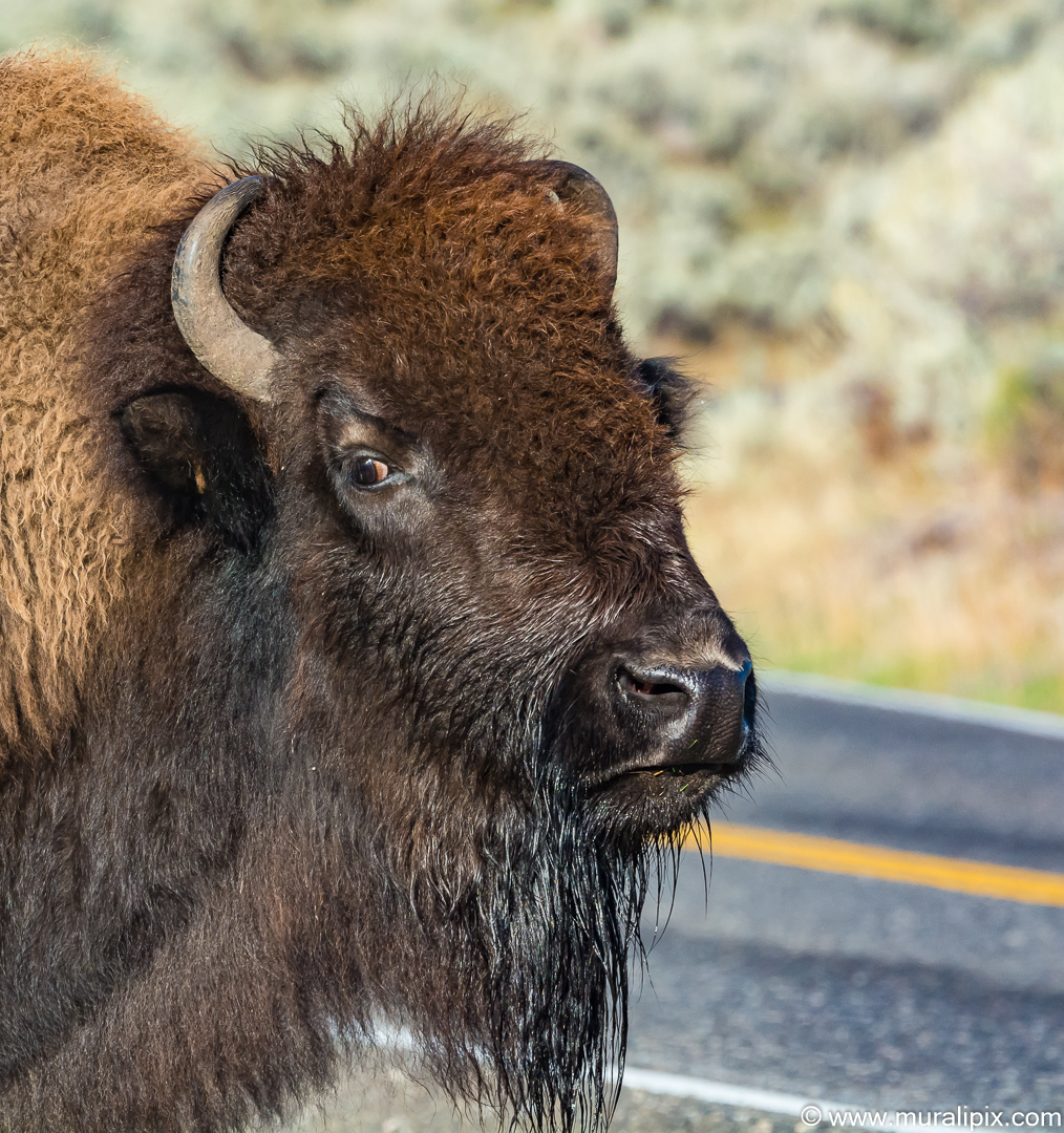
Nikon D7100 320mm f11 1/800 ISO1100
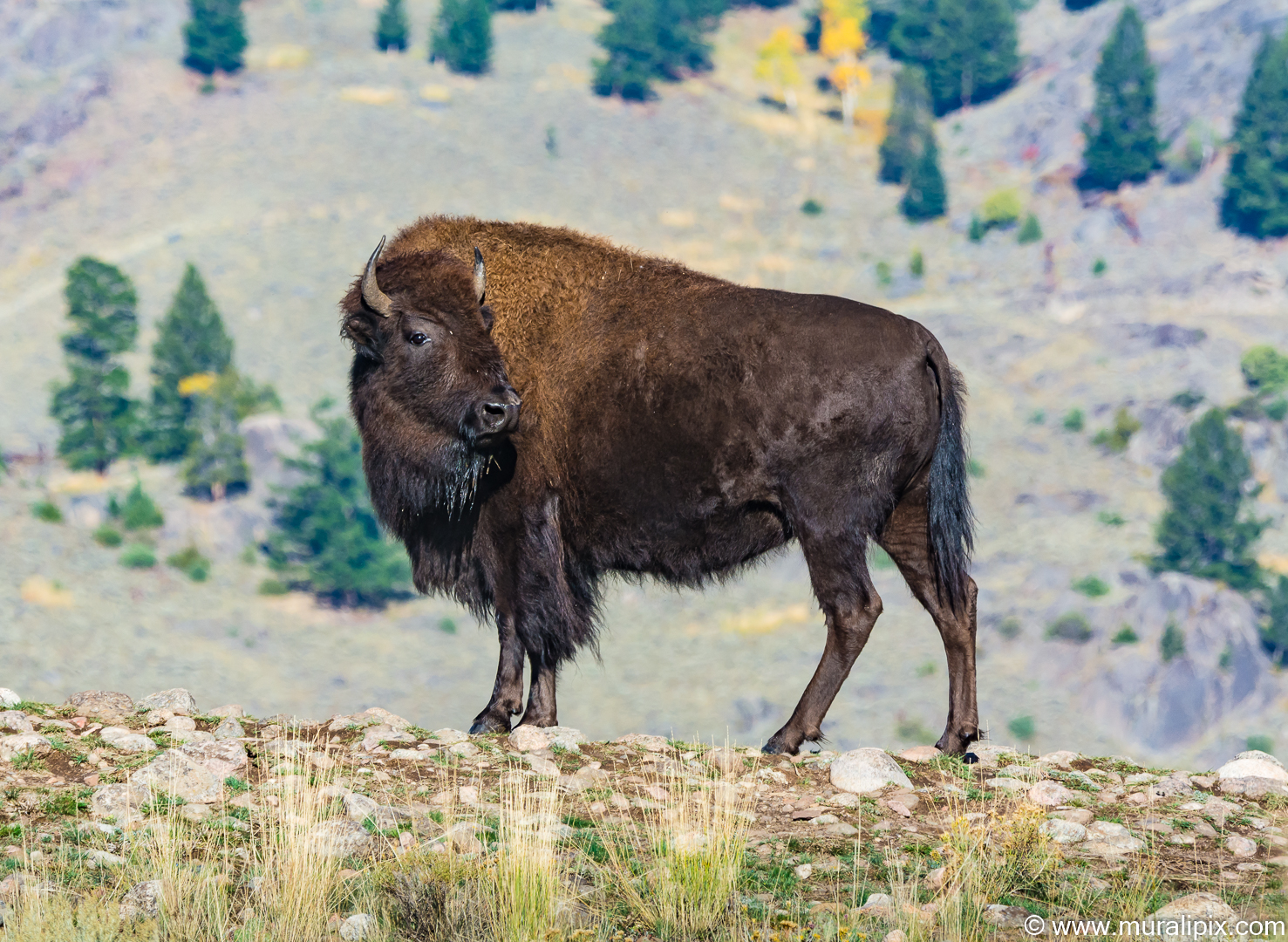
Nikon D7100 260mm f8 1/800 ISO400
A short walk from a turnout on Grand Loop Road just north of Tower Fall brought us to Calcite Springs Overlook, perched on a bluff above the narrowest section of the Grand Canyon of Yellowstone. The mesmerizing northward view puts a rugged section of the Yellowstone River on display, accented by bleached cliffs and steam venting hydrothermal springs. The loop to the viewing platform is a quarter mile long, and well worth the effort.
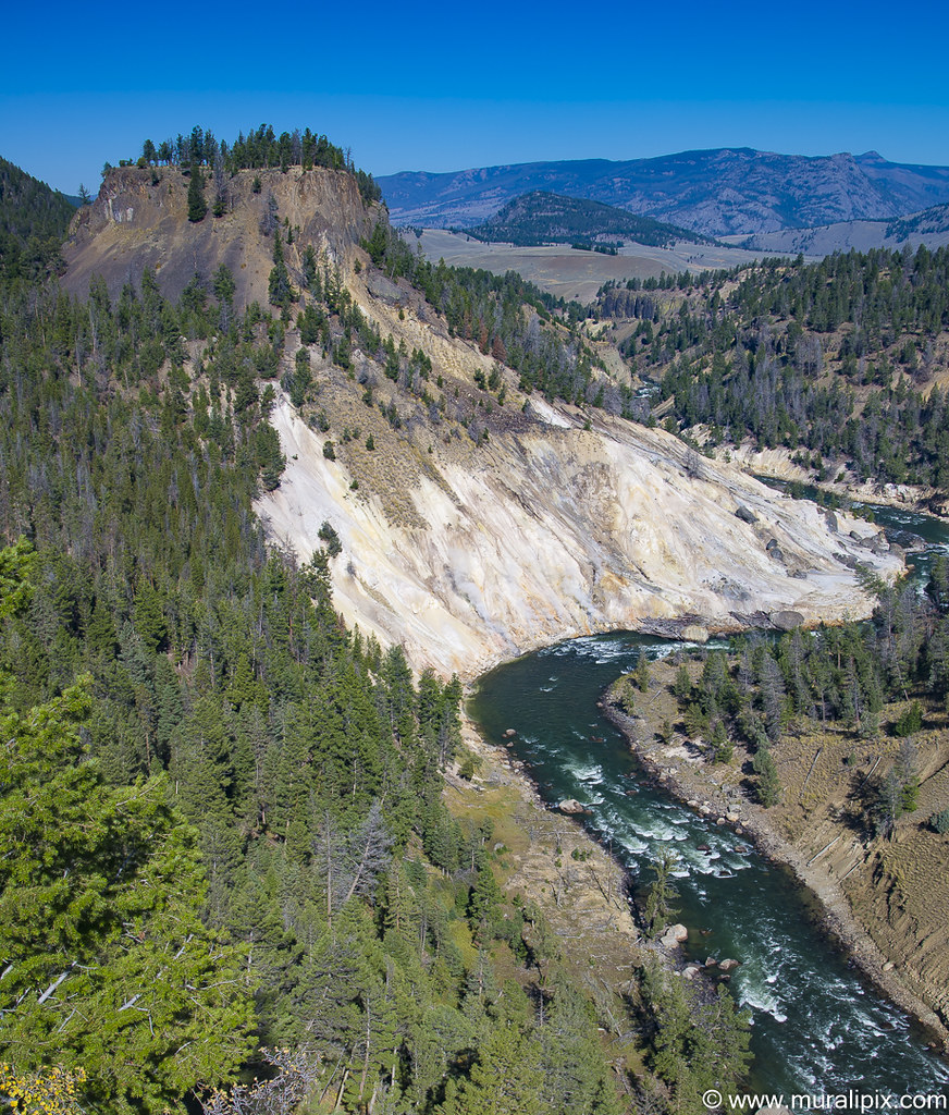
Nikon D610 34mm f13 1/30 ISO100
(44°54’9″ N 110°23’33” W)
We reached the Grand Canyon of Yellowstone in the late afternoon. We took a few strolls around the area but didn’t shoot many pictures as lighting was not optimal. We checked into the lodge and relaxed.
Day 3 – Sep 21 (Grand Canyon of Yellowstone to Yellowstone Lake)
After a quick breakfast, we drove towards the Artist Point. We parked the vehicle near the bridge over the Yellowstone River on South Rim Drive and hiked north and photographed the rapids before the water reached the Upper Falls.
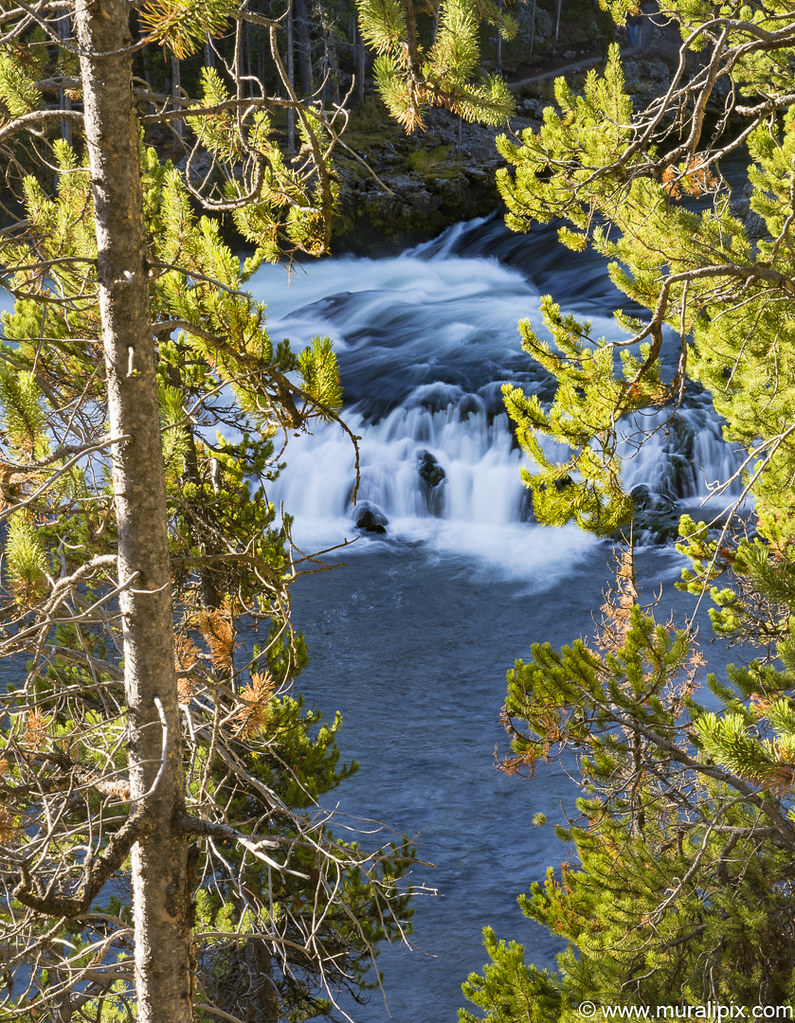
Nikon D610 70mm f22 0.8sec ISO100
(44.711296, -110.501953)
Artist Point is one of the marquee overlooks on the Grand Canyon of the Yellowstone River, with an exceptional perspective of canyon’s most famous feature, the 308-foot Lower Falls. The viewpoint juts out from the south wall of the canyon and is just a short 0.1-mile walk from South Rim Drive. Looking up the canyon, you’ll see a powerful waterfall contained by a deep V-shaped canyon of colorful orange rocks. Lower Falls is about a mile up the canyon from Artist Point. It is estimated that between 5,000 and 60,000 gallons of water rush over Lower Falls each second, depending on the season. We spent close to 2 hours enjoying the scenery and shooting images from the Artist Point.
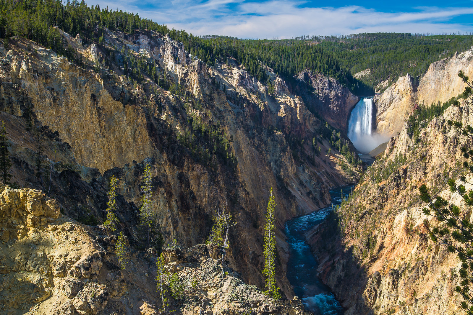
Nikon D610 42mm f16 1/13 ISO100
(44.721092, -110.479094)
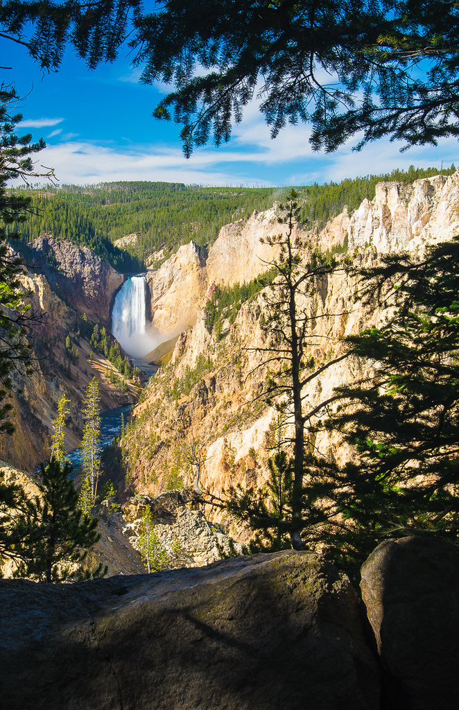
Nikon D610 48mm f16 1/15 ISO100
(44.721092, -110.479094)
On the side of the road between the Grand Canyon area and Yellowstone Lake, you will find several interesting hydrothermal features. We stopped at three of them. The first one we encountered was the Sulphur Caldron. The ripe-smelling caldron is nearly as acidic as battery acid and ten times as acidic as lemon juice. Even so, some microorganisms have found a way to live in this environment. A sign at the overlook explains: Billions of thermoacidophiles live in Sulphur Caldron. They convert the pool’s hydrogen sulfide gas into sulfuric acid. The sulfuric acid breaks soil and rock into mud, making this pool a very muddy home.
Nikon D610 24mm f13 1/40 ISO100
(44.627814, -110.433119)
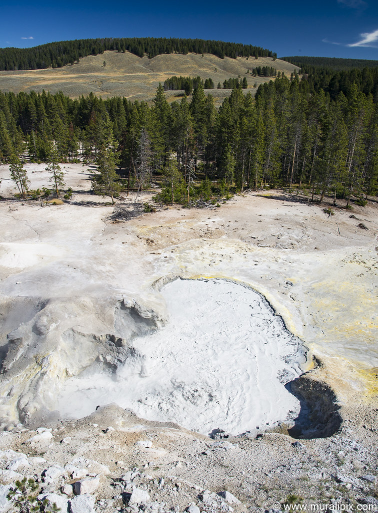
The second stop had two features – the Dragon’s Mouth Spring and the Mud Volcano.
As you step out of your vehicle at the trailhead, you won’t be greeted by pine fresh mountain air. Instead you’ll be smacked in the face by a rotten egg smell caused by the hydrogen sulfide gas that escapes from the ground in this area, atop a resurgent dome in the magma chamber of the Yellowstone Caldera. It is worth tolerating the smell to see all that the Mud Volcano Area has to offer.
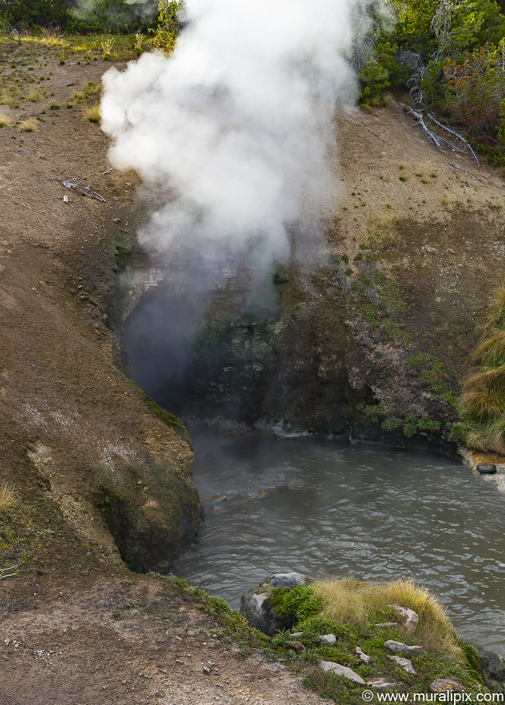
Dragon’s Mouth Spring is a small pool backed up against a hillside where a water and steam spew out of a cave, producing a roaring sound. A sign at Dragon’s Mouth Spring reads:
An unknown park visitor named this feature around 1912, perhaps due to the water that frequently surges from the cave like the lashing of a dragon’s tongue. Until 1994, this dramatic wave-like action often splashed water as far as the boardwalk. The rumbling sounds are caused by steam and other gasses exploding through the water, causing it to crash against the walls of the hidden caverns.
Nikon D610 38mm f14 1/30 ISO100
(44.625190, -110.434784)
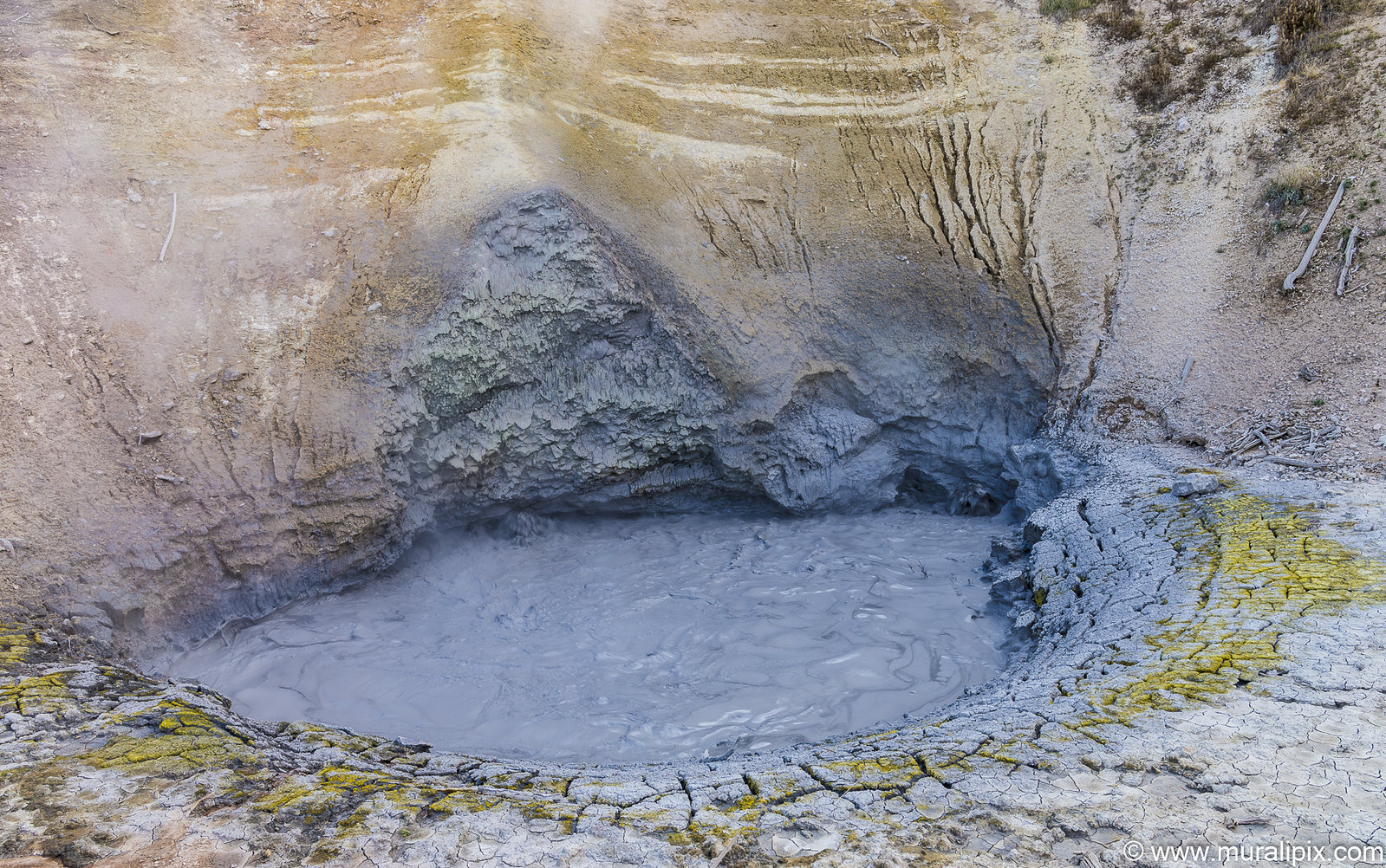
At the nearby Mud Volcano, you’ll see a smaller pool of bubbling muddy water surrounded by cracked dry mud. When discovered by explorers in 1870, the Mud Volcano was much more impressive. It had a tall cone from which it would erupt, shaking the earth, and shooting mud into the air.
By 1872, Mud Volcano had ruptured and blown itself apart from all the activity. Today you will not see a cone, but rather a steaming muddy pool framed by a crater-shaped wall that was once the interior of the cone.
In 1870, Nathaniel Langford explored the area with General Washburn, and published this account of Mud Volcano: Dense volumes of steam shot into the air with each report, through a crater thirty feet in diameter. The reports, through irregular, occurred as often as every five seconds, and could be distinctly heard half a mile [away]. Each alternate report shook the ground a distance of two hundred yards or more, and the massive jets of vapor which accompanied them burst forth like the smoke of gunpowder.
Nikon D610 27mm f14 1/20 ISO100
(44.624407, -110.434506)
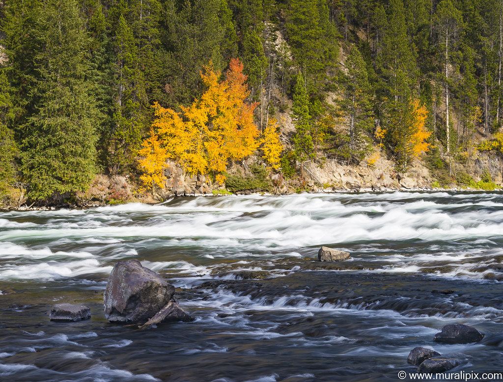
A few miles south of the Mud Volcano are the Le Hardy Rapids, one of the best spots to photograph pelicans feasting on trout in the spring. We didn’t see any birds but the fall foliage across the river was impressive.
Nikon D610 62mm f22 1/5 ISO100
(44.607560, -110.384704)
We checked into Lake Lodge at the shores of Yellowstone Lake for the night.
Day 4 – Sep 22 (Yellowstone Lake to Jackson Hole, WY)
In the summer, Yellowstone has between 10,000 & 2000 elks in 6-7 heards that dwindle down to about 5000 in the winter. We came across a male bull with massive antlers south of the West Thumb area. As it was the “rut” season, I decided to shoot from inside the car.
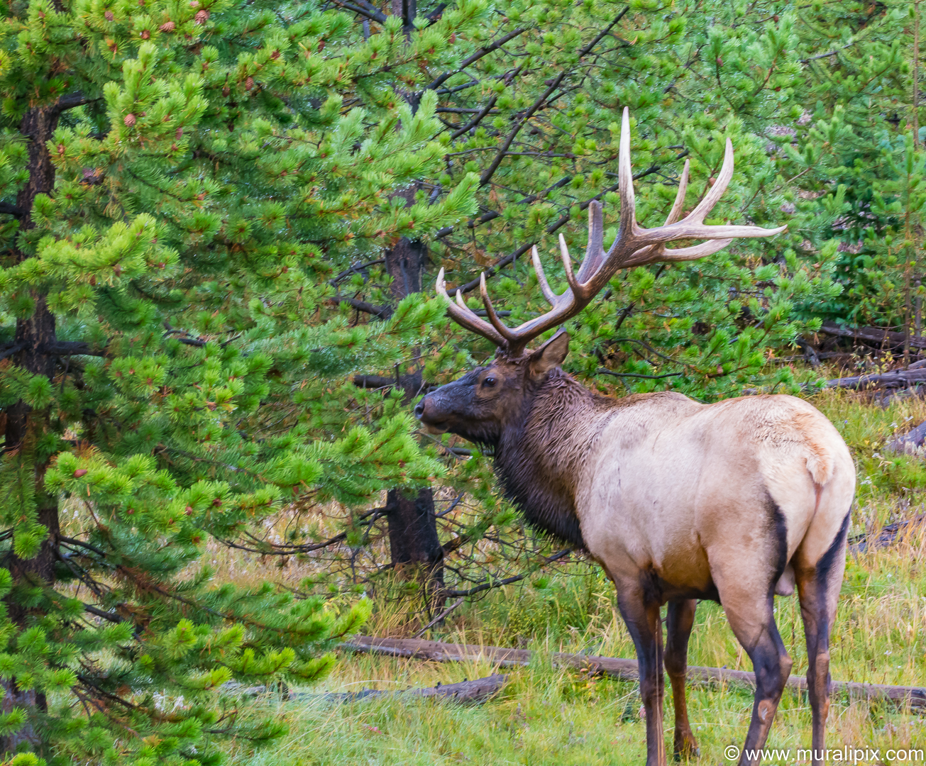
Nikon D7100 80mm f16 1/40 ISO1250
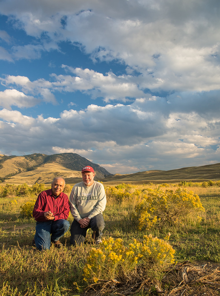
A continental divide is a drainage divide on a continent such that the drainage basin on one side of the divide feeds into one ocean or sea, and the basin on the other side either feeds into a different ocean or sea, or else is endorheic, not connected to the open sea. The Continental Divide of the Americas, also called the Great Divide, separates the watersheds of the Pacific Ocean from those of the Atlantic and Arctic Oceans. It runs from the Seward Peninsula in Alaska, through western Canada along the crest of the Rocky Mountains, including through Glacier National Park, Yellowstone National Park, and Rocky Mountain National Park, to New Mexico. From there, it follows the crest of Mexico’s Sierra Madre Occidental and extends to the tip of South America. It is crossed by the Panama Canal and by the two outlets of Isa Lake in Yellowstone National Park. We stopped at the divide near Riddle Lake to shoot a selfie.
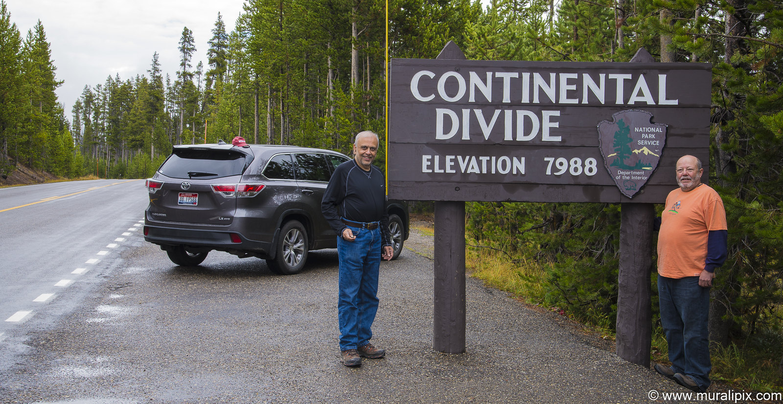
Nikon D610 48mm f13 1/8 ISO100
(44.359604, -110.581316)
It was a cloudy day which means the conditions were ideal to photograph waterfalls. Two were on our list.The first was Lewis Falls, a mile south of the Lewis Lake Campground. We parked our car on the northern side of the bridge over Lewis River and hiked a short distance along the northern shores of the river. We found a good spot with a bunch of rocks with moss in the foreground.
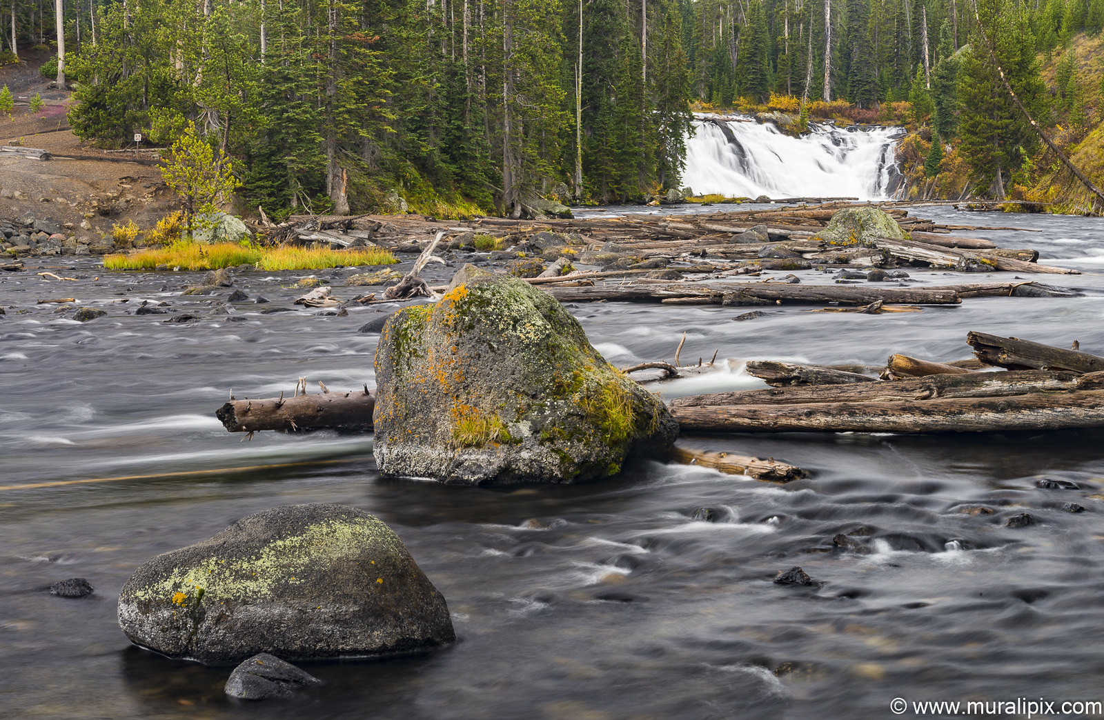
Nikon D610 65mm f22 1.6sec ISO100
(44.267987, -110.634665)
Moose Falls is just about 1.5 miles north of the south entrance. There are spots for 4-5 vehicles at the trailhead and a short walk will get you close to the falls. The fall foliage were at their peak but we did not find any moose in the area :-(. With a wide angle lens, you can shoot the falls and the fall foliage and rocks in the foreground.
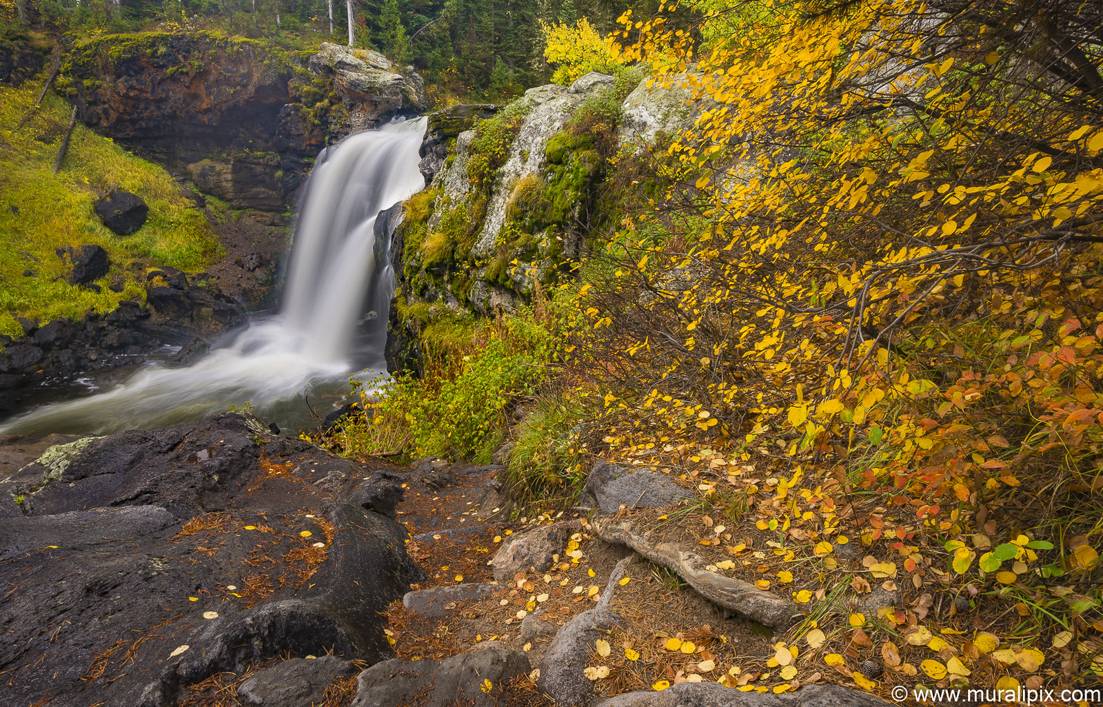
Nikon D610 20mm f22 1.3sec ISO100
(44.151999, -110.672704)
We reached Grand Tetons NP just after lunch and we headed to the Cunningham Cabin Historial Site in Moose, WY. The cabin stands as one of the valley’s few remaining structures from the homesteading era when settlers filed nearly 400 claims in Jackson Hole. In the 1880s, John and Margaret Cunningham staked a claim for the Bar Flying U Ranch. Cunningham built his cabin in 1888 in the Appalachian style, commonly called “double-pen” or “dog-trot.” John lived in the cabin until 1895 when he finished his main residence, and it later became a smithy and barn.
Cunningham ran a profitable ranch until drought ruined his crops and cattle prices fell at the end of World War I. As an agricultural depression persisted through the 1920s, Cunningham and other ranchers recognized the valley’s potential as a “playground.” Cunningham teamed up with neighbor Josiah David “Si” Ferrin to write a petition signed by 97 valley ranchers. The petition proposed a buyout of ranches to create a national recreation area for public enjoyment. In 1928, Cunningham sold to the Snake River Land Company who later donated 35,000 acres for park expansion. Below is the view from the back of the ranch house.
Nikon D610 16mm f13 1/160 ISO100
(43.778591, -110.558406)
We checked into Flat Creek Inn in Jackson Hole.
Day 5 – Sep 23 (Jackson Hole to West Thumb Geyser Basin)
After breakfast, we started to drive towards Jenny Lake area. The first stop was at the The Chapel of the Transfiguration in Moose, WY, a small log chapel, built in 1925 to serve guests and employees of the dude ranches that stretched north of Jackson along the base of the Teton Range. The 22-foot by 50-foot T-shaped chapel has exposed log interior walls with stained glass windows on either side. Behind the altar on the chapel’s axis, a picture window that would be anachronistic in another setting frames a spectacular view of the Cathedral Group that substitutes for a stained glass composition. As the Tetons were totally cloud covered, we couldn’t shoot from inside the chapel but the aspens around the chapel provided some interesting opportunities. We decided to get back to the chapel next day to capture the Cathedral Group from inside.
Nikon D610 105mm f13 1/125 ISO1250
(43.661247, -110.717449)
Nikon D610 100mm f16 1/13 ISO100
(43.660087, -110.715012)
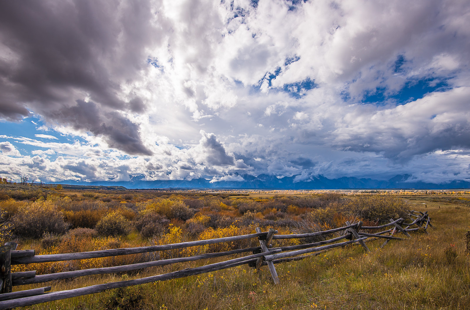
We stopped by the Lupine Meadows area on the way to Jenny Lake. The fall colors were in abundance. Here is a shot of a lonely tree.
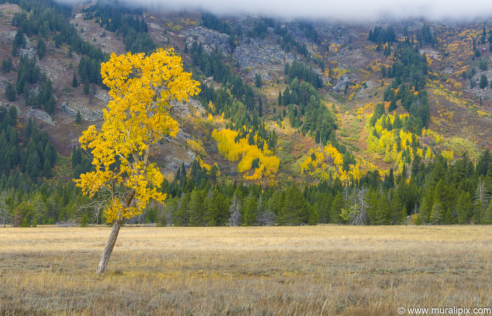
Nikon D610 75mm f13 1/50 ISO100
(43.742413, -110.732886)
On the Jenny Lake road near the Cathedral Group View turnout, we got a peekaboo view of the group.
Nikon D610 82mm f13 1/320 ISO320
(43.791875, -110.709050)
After a lunch at the Signal Mountain Lodge, we stopped by the famous Oxbow Bend. Although the light was harsh with the sun overhead, the scene was so beautiful, we decided to take a few shots.

Nikon D610 52mm f13 1/40 ISO100
(43.866116, -110.548333)
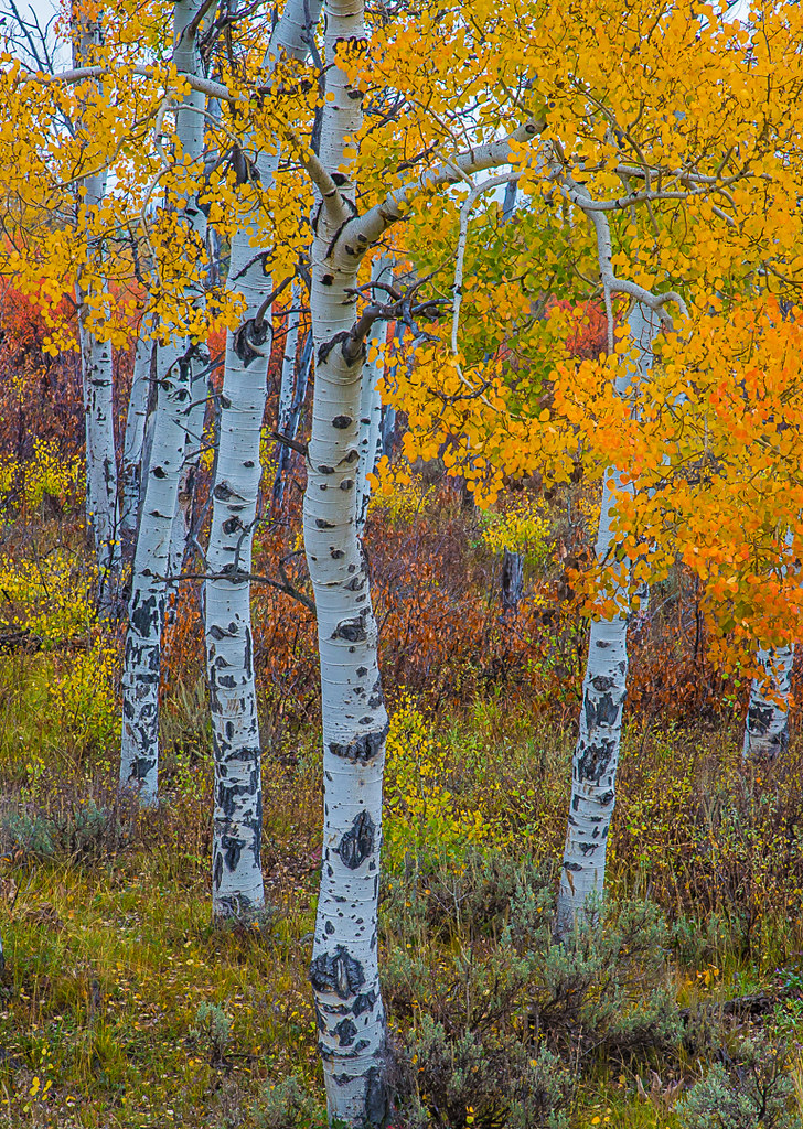
Near the Oxbow bend, we spotted a bunch of Aspen trees with bright yellow leaves and we took a shot of them as well.
Nikon D610 78mm f16 1/25 ISO100
(43.865449, -110.567284)
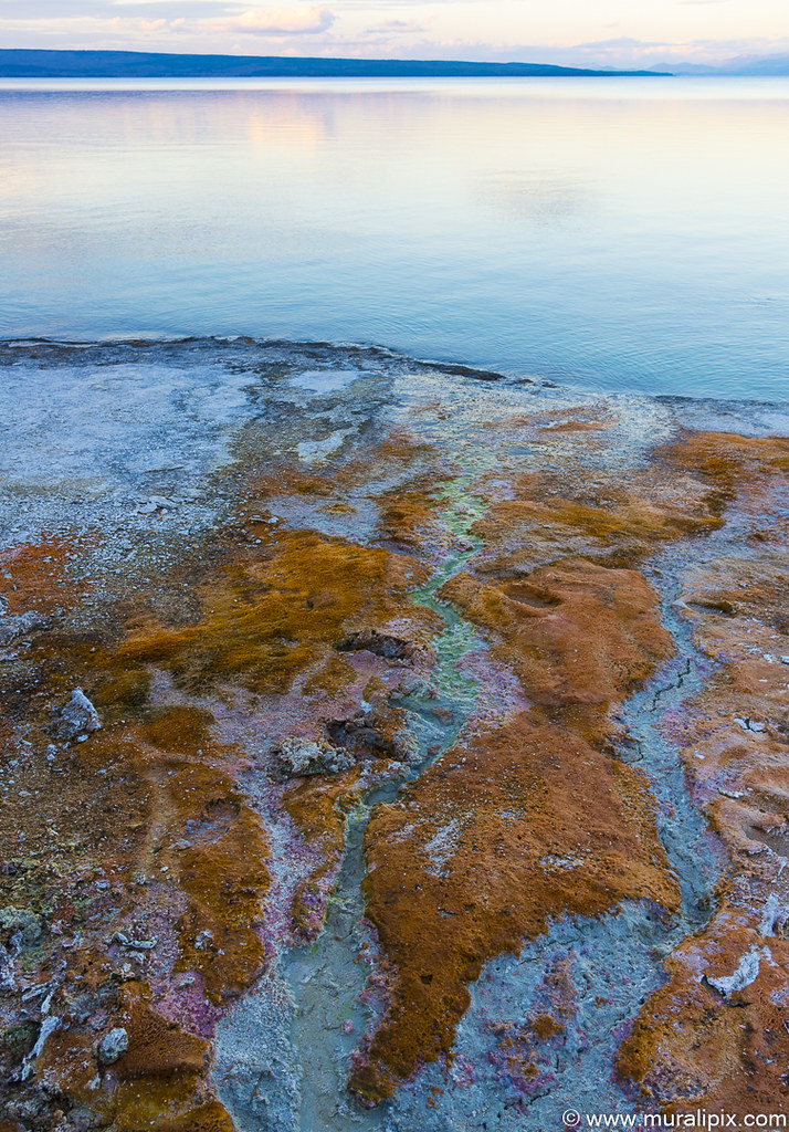
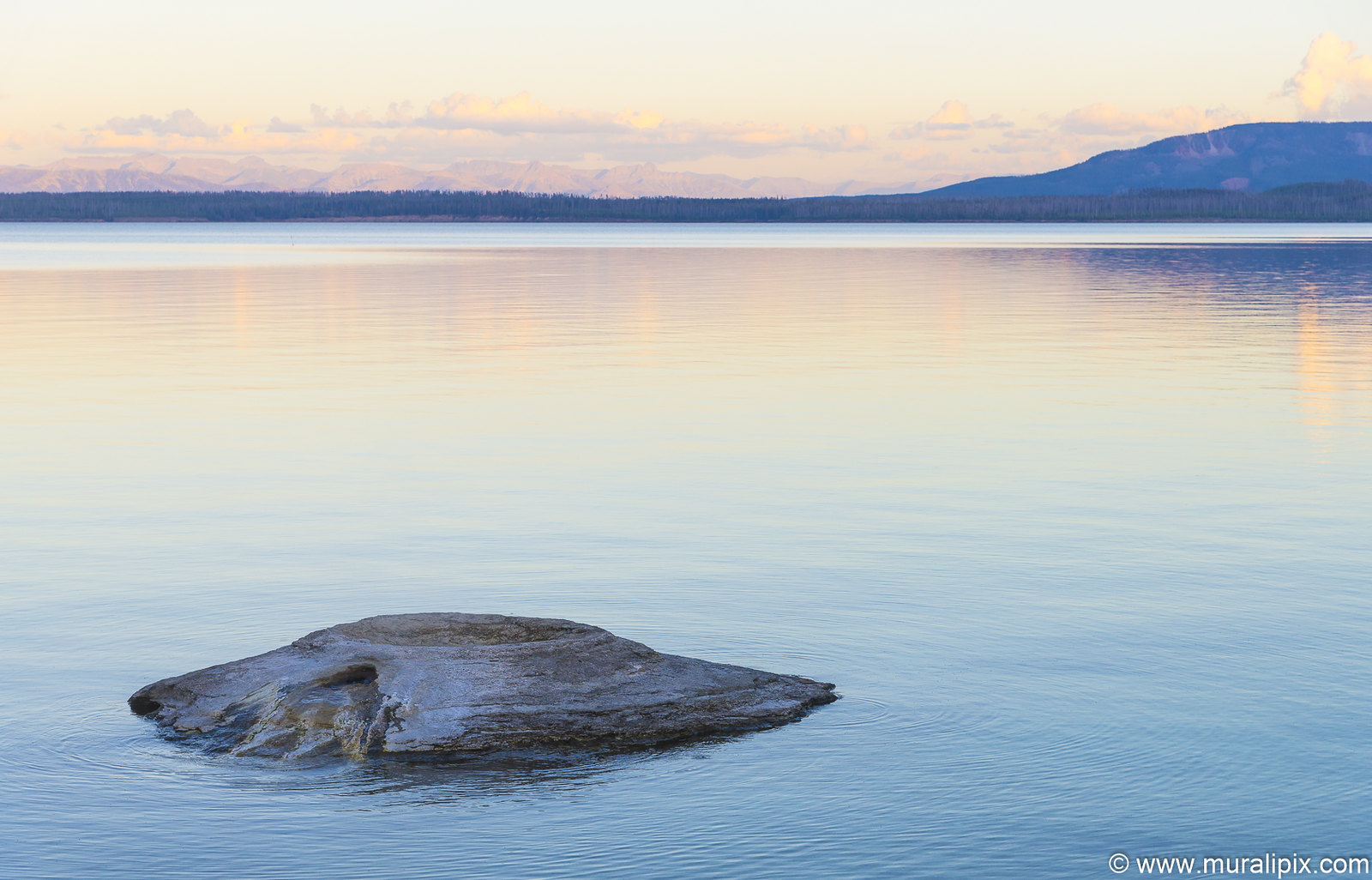
We returned to the West Thumb Geyser Basin in Yellowstone at sunset time and walked the trail. The Basin is the largest geyser basin on the shores of Yellowstone Lake. The heat source of the thermal features in this location is thought to be relatively close to the surface, only 10,000 feet down. West Thumb is about the same size as another famous volcanic caldera, Crater Lake in Oregon, but much smaller than the great Yellowstone Caldera which last erupted about 640,000 years ago. It is interesting to note that West Thumb is a caldera within a caldera.
West Thumb was created approximately 162,000 years ago when a magma chamber bulged up under the surface of the earth and subsequently cracked it along ring fracture zones. This in turn released the enclosed magma as lava and caused the surface above the emptied magma chamber to collapse. Water later filled the collapsed area of the caldera, forming an extension of Yellowstone Lake. This created the source of heat and water that feed the West Thumb Geyser Basin today.
The thermal features at West Thumb are not only found on the lake shore, but extend under the surface of the lake as well. Several underwater hydrothermal features were discovered in the early 1990s and can be seen as slick spots or slight bulges in the summer. During the winter, the underwater thermal features are visible as melt holes in the icy surface of the lake.The surrounding ice can reach three feet in thickness.
Nikon D610 28mm f8 1/60 ISO400
(44.416542, -110.569829)
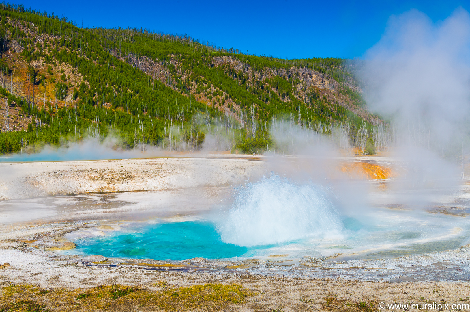
Perhaps the most famous hydrothermal feature at West Thumb is a geyser on the lake shore known as Fishing Cone. In the earlier part of the 20th century, this cone had eruptions as high as 40 feet. As the water level in Yellowstone Lake has increased, the cone is now inundated during the spring and the temperatures in the cone have cooled enough that it no longer erupts and is now considered a hot spring.
Nikon D610 78mm f8 1/250 ISO400
(44.417249, -110.570402)
The second geyser we saw was the Big Cone Geyser. As the water level was low, we could see it boiling but no eruption was imminent.
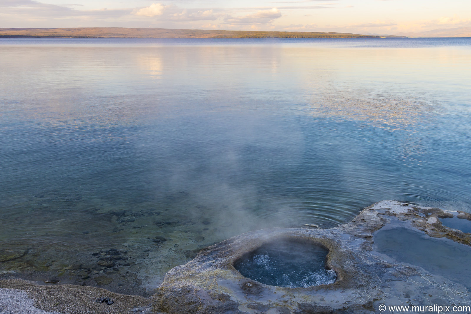
Nikon D610 34mm f8 1/200 ISO400
(44.417583, -110.570698)
Day 6 – Sep 24 (Grand Teton NP & Norris Geyer Basin)
The sky cleared a bit on day 6 and we decided to drive back to the GT National Park to reshoot at some of the spots we passed last 2 days. First stop was at the iconic Oxbow Bend. Over a dozen photographers were already at work. We got a few good shots.
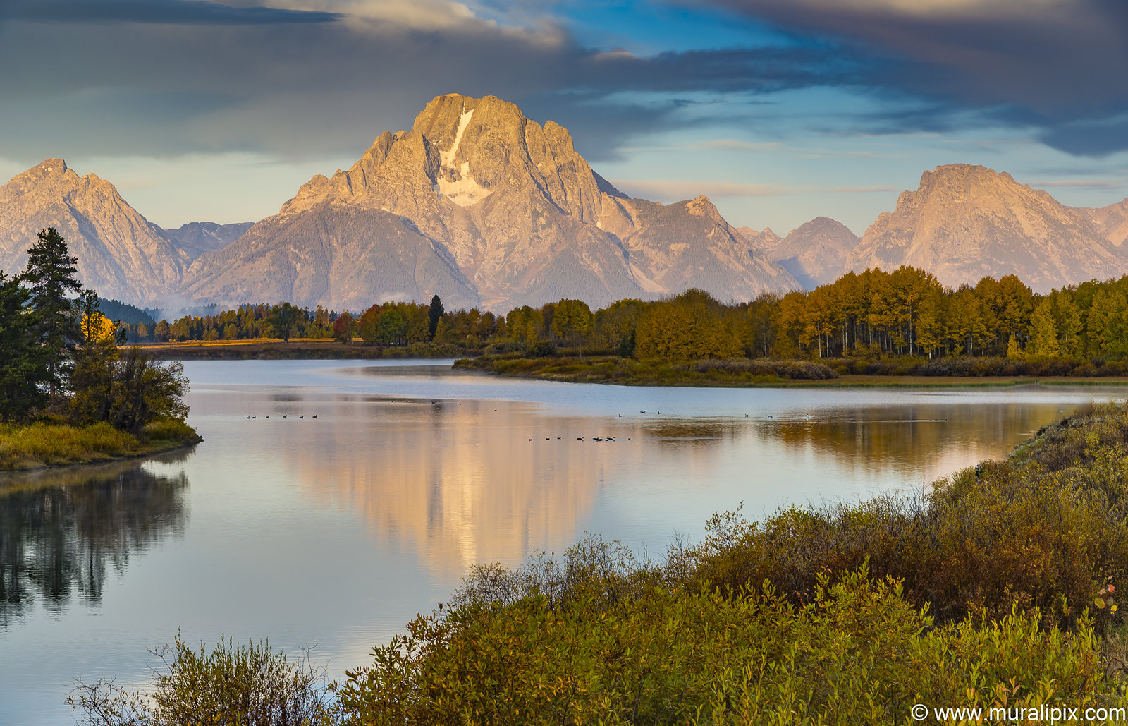
Nikon D610 78mm f13 1/10 ISO100
(43.866151, -110.548547)
Just before the turn out for the Cunningham Cabin, we located the gate to the Moose Head Ranch. We used the gate to frame the Tetons.
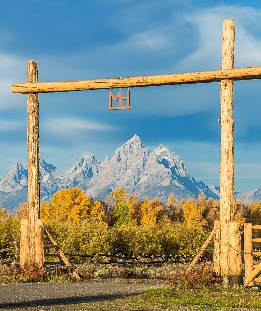
Nikon D610 95mm f13 1/50 ISO100
(43.787740, -110.540286)
Pronghorns are one of North America’s most interesting mammals. Not only do pronghorns have the longest land migration in the continental United States, they also are the fastest land animal in North America. They can run at speeds close to 60 miles per hour. Although pronghorns are not as fast as cheetahs, they maintain a fast speed for a longer period of time than cheetahs. We came across one while driving towards Snake River Overlook.
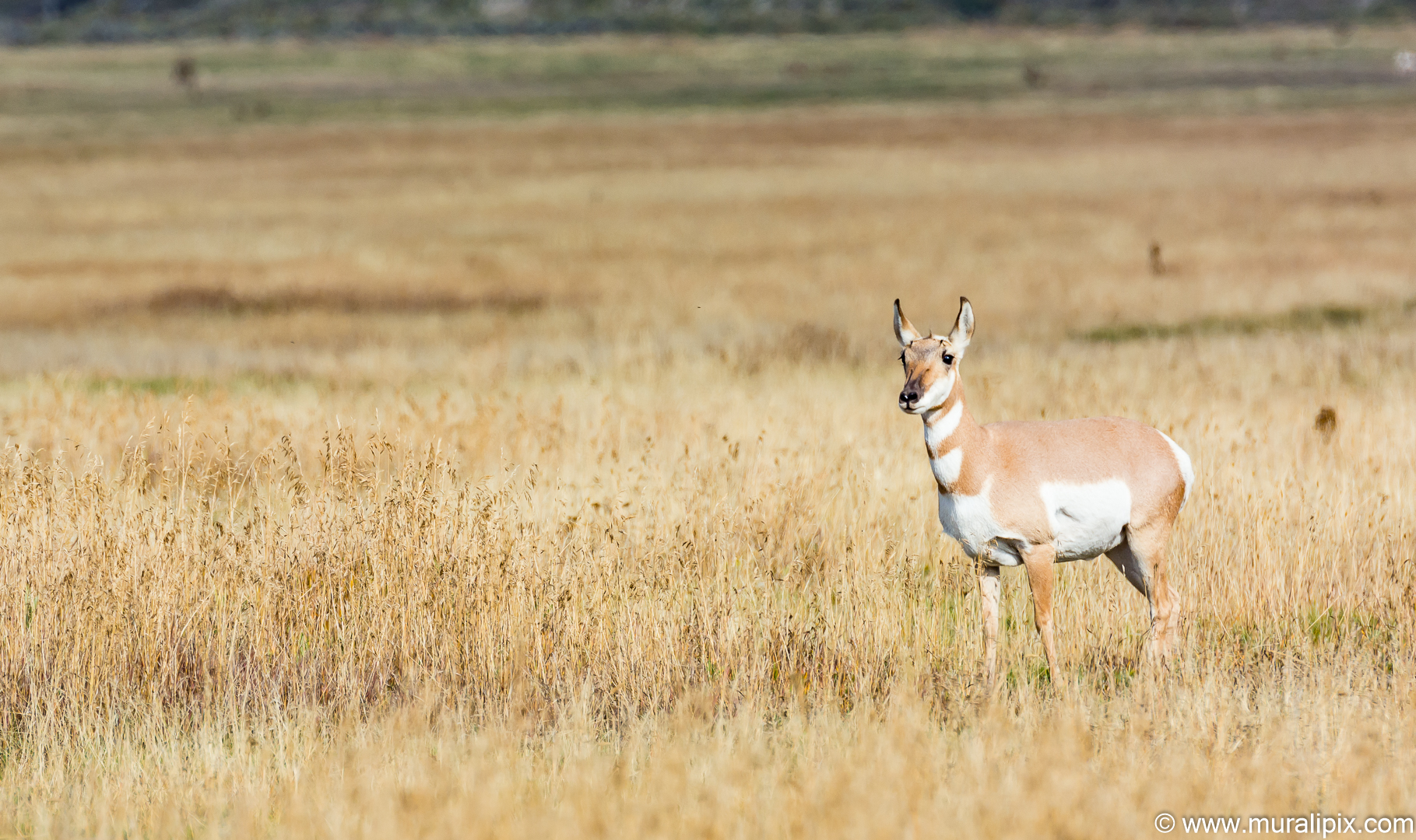
Nikon D7100 500mm f8 1/500 ISO280
By the time we reached the famous Snake River Overlook, the light was getting to be a bit harsh. The evergreens have grown much taller since the scene was made world famous by Mr. Ansel Adams.
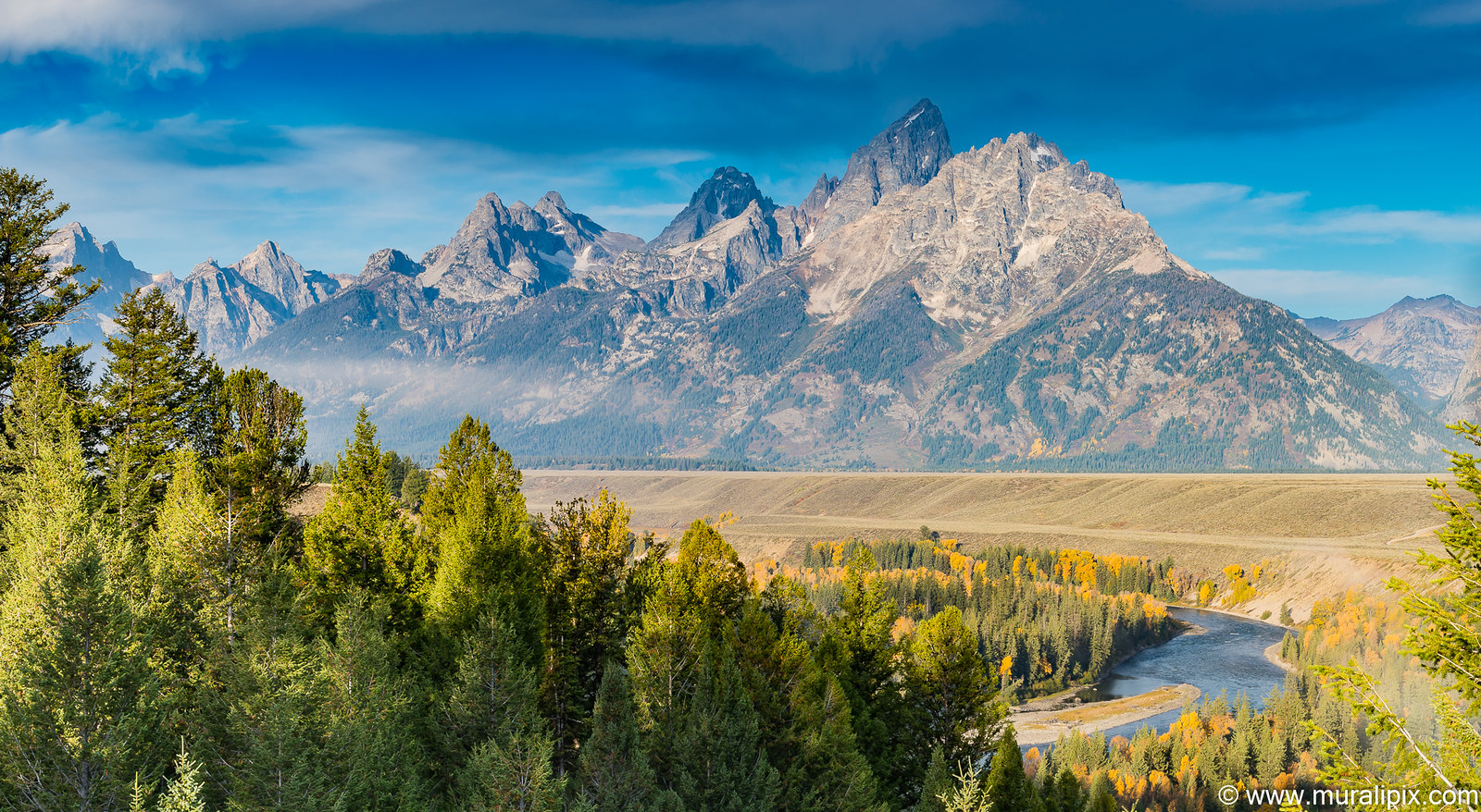
Nikon D610 55mm f13 1/30 ISO100
(43.754319, -110.623814)
Leaders of The Church of Jesus Christ of Latter-day Saints, or Mormons, sent parties from the Salt Lake Valley to establish new communities. Mormon homesteaders, who settled east of Blacktail Butte near the turn of the 19-century, clustered their farms to share labor and community, a stark contrast with the isolation typical of many western homesteads. These settlers first arrived in the 1890s from Idaho establishing a community (named Grovont by the U.S. Post Office) known today as “Mormon Row.” Despite the harsh conditions of Jackson Hole, Mormon settlers grew crops by using irrigation. These hardy settlers dug ditches by hand and with teams of horses, building an intricate network of levees and dikes to funnel water from central ditches to their fields between 1896 and 1937. Water still flows in some of these ditches. Today, two picturesque barns highlight Mormon Row.
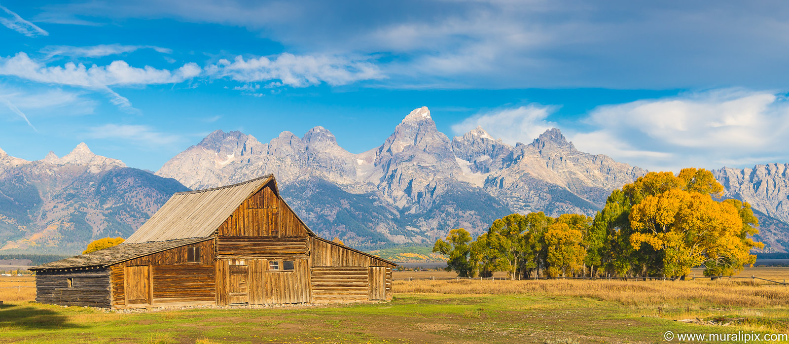
Nikon D610 46mm f4 1/250 ISO100
(43.660739, -110.664383)
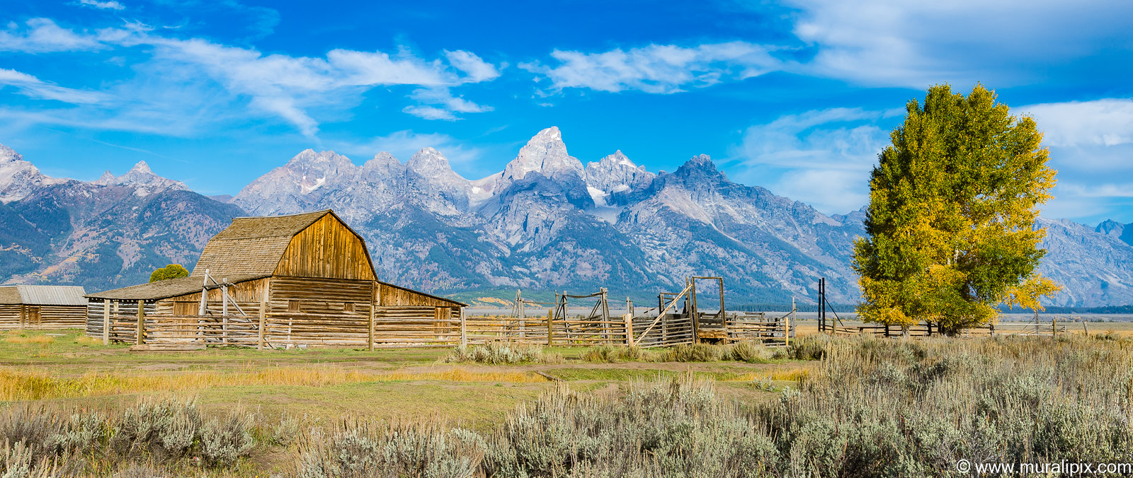
Nikon D610 38mm f16 1/50 ISO100
(43.666490, -110.664165)
We returned to The Chapel of the Transfiguration in Moose, WY to shoot the Cathedral Group through the window behind the alter. As Larry and I were the only ones at the chapel, we had plentty of time to setup our tripods and shoot away.
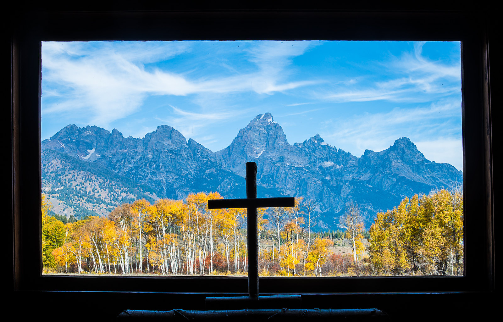
Nikon D610 52mm f16 1/25 ISO100
(43.660194, -110.715396)
We then drove towards Jackson Lake. We found a good spot to shoot the Tetons reflected on the Jackson Lake.
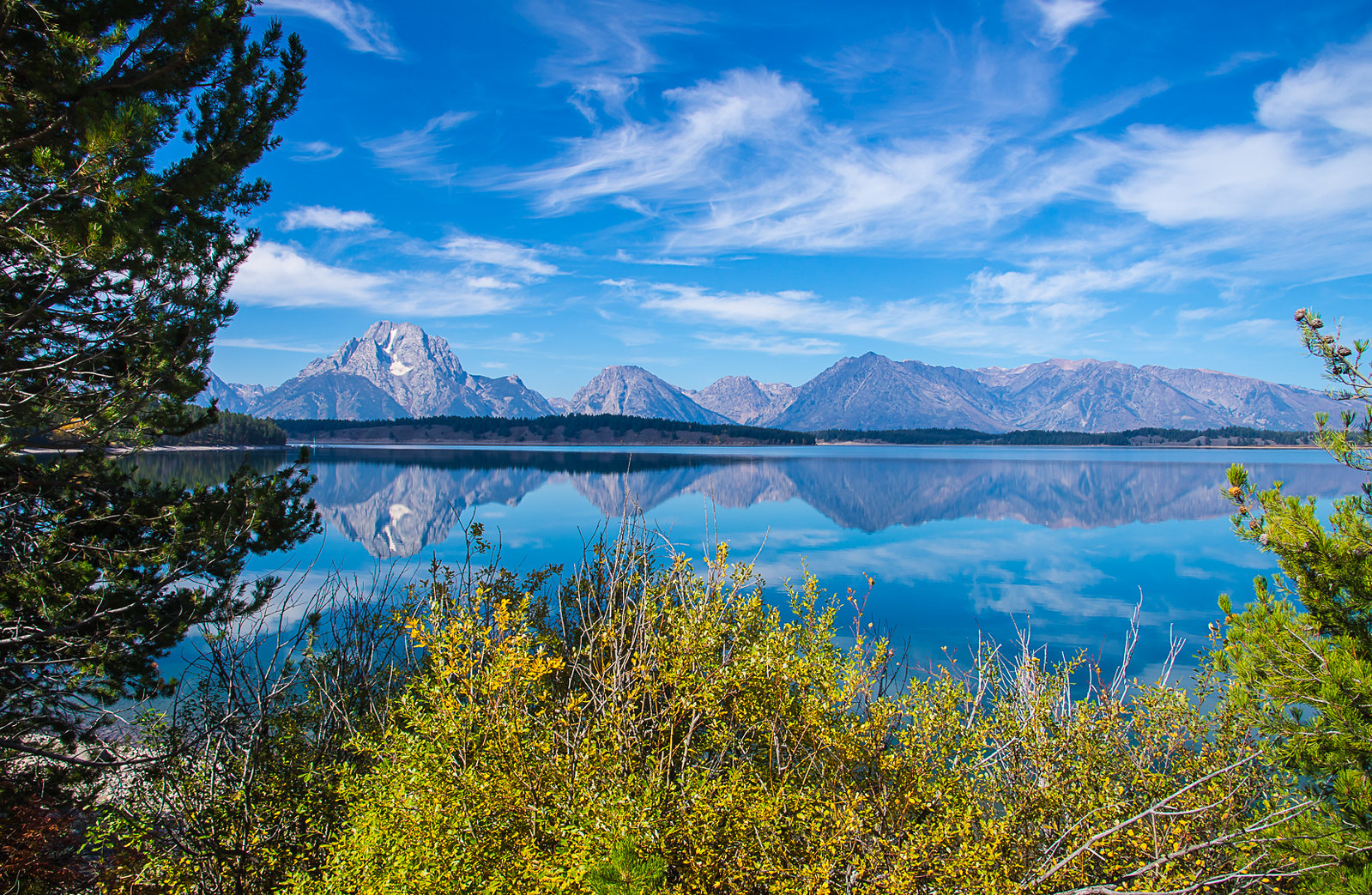
Nikon D610 24mm f16 1/125 ISO400
(43.848925, -110.593901)
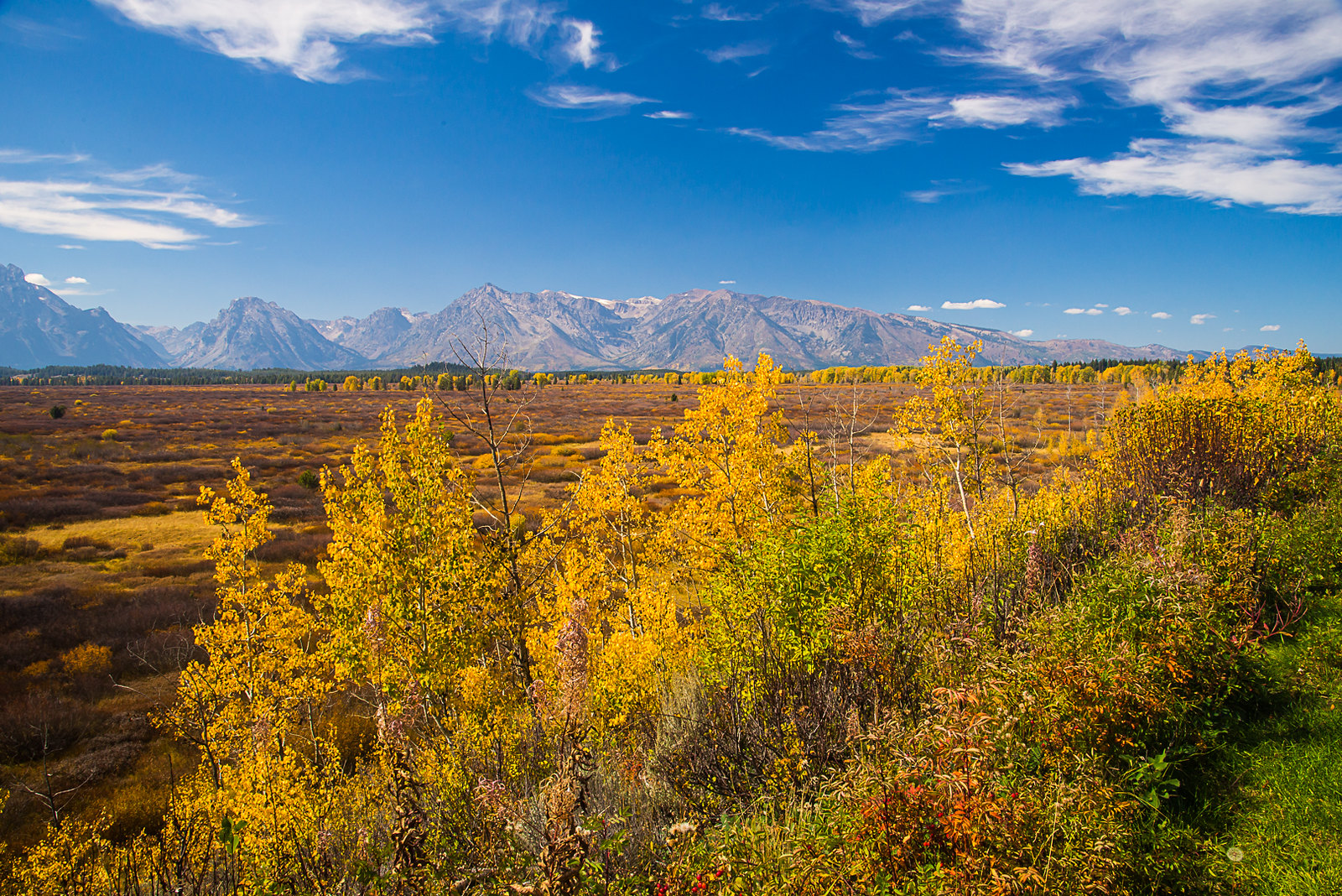
From that spot, if you turned 180 degrees, you could see awesome fall foliage.
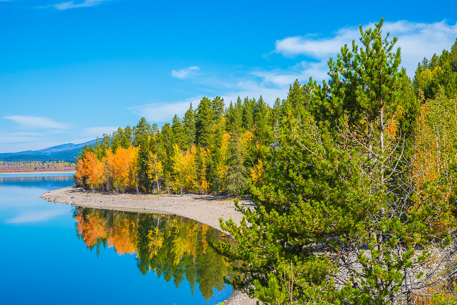
Nikon D610 66mm f16 1/100 ISO400
(43.848925, -110.593901)
We reached the Jackson Lake Lodge for lunch. The dining room was packed with doctors attending a conference at the Lodge. After a few minutes wait, we were seated. The launch was terrific. The view from the back of the dining area of the lodge was spectacular.
Nikon D610 27mm f16 1/50 ISO400
(43.877699, -110.578069)
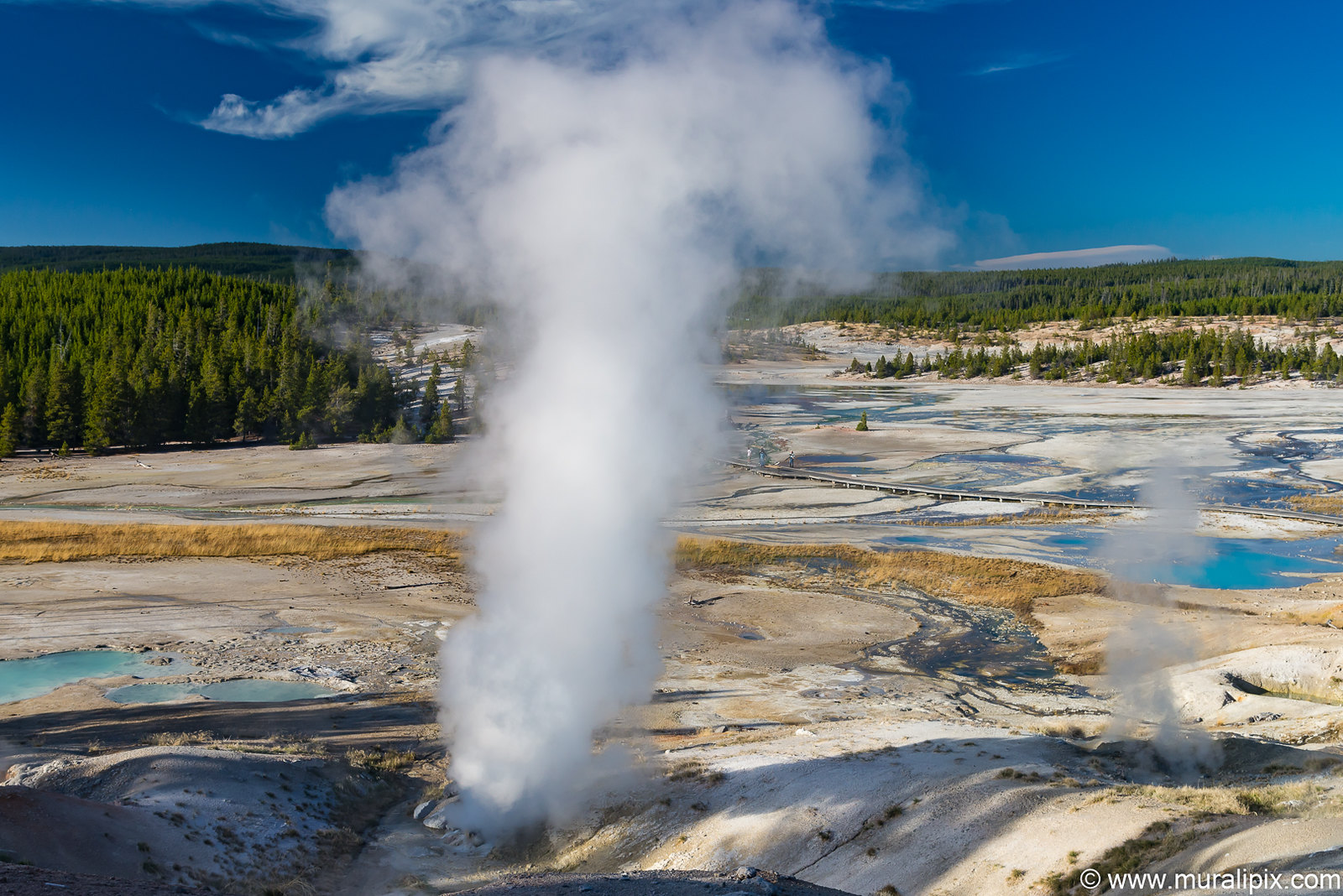
We reached the Norris Geyser Basin at around 4pm. It is the hottest geyser basin in the park and is located near the northwest edge of Yellowstone Caldera near Norris Junction and on the intersection of three major faults. Unlike most of other geyser basins in the park, the waters from Norris are acidic rather than alkaline.
We walked the Backbasin & Porcelain basin trails for 2 hours and saw 3 geysers in action. The first stop was at the Steamboat Geyser, the tallest active geyser in the world, located in the Back Basin. Unlike the slightly smaller but much more famous Old Faithful Geyser located in Upper Geyser Basin, Steamboat has an erratic and lengthy timetable between major eruptions. During major eruptions, which may be separated by intervals of more than a year (the longest recorded span between major eruptions was 50 years), Steamboat erupts over 300 feet into the air. Steamboat does not lie dormant between eruptions, instead displaying minor eruptions of approximately 40 feet.
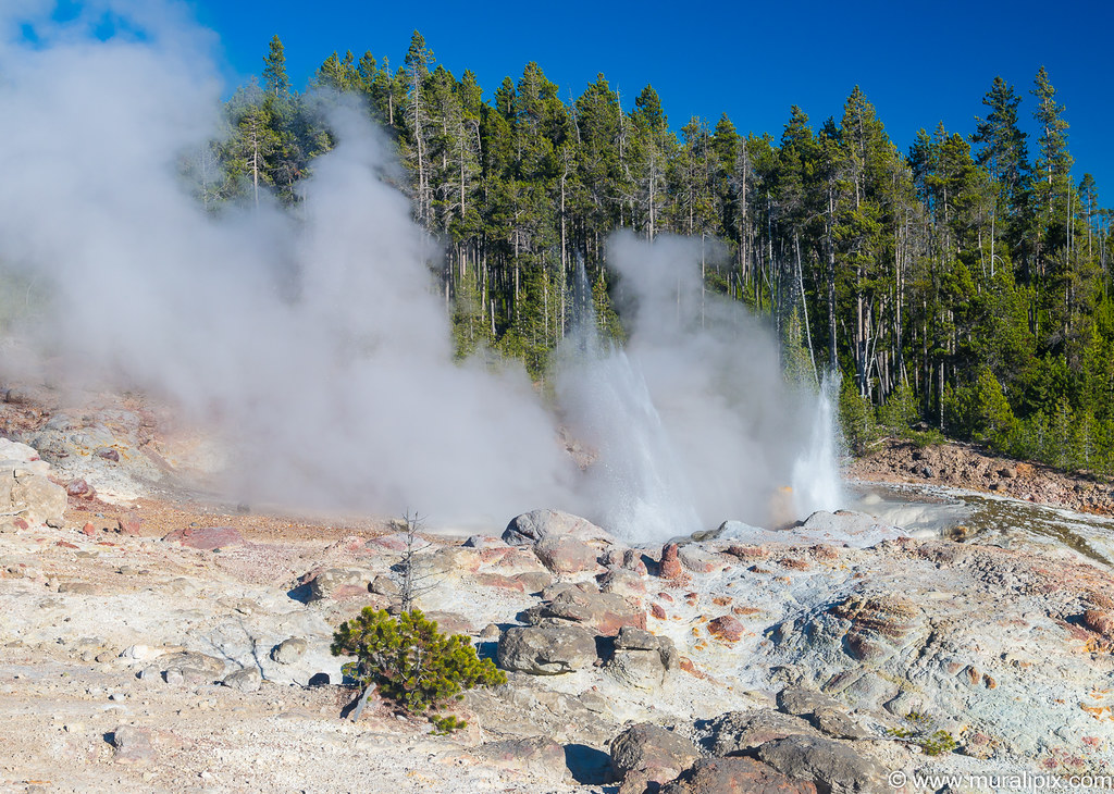
Nikon D610 44mm f13 1/160 ISO400
(44.723410, -110.703431)
Vixen Geyser is a small geyser in the Back Basin that erupts sporadically and the interval can vary between tens of minutes to days. We were super lucky to see it erupt.
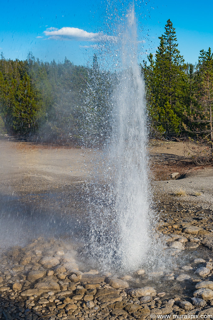
Nikon D610 52mm f10 1/160 ISO400
(44.722908, -110.707017)
In the Porcelain Basin, the Black Growler Steam Vent was quite active.
Nikon D610 40mm f9 1/200 ISO400
(44.727136, -110.703523)
We stopped at the Gibbon Falls for a few minutes on our way to our hotel in West Yellowstone for the night.
Nikon D610 34mm f14 2sec ISO400
(44.652428, -110.771749)
Day 7 – Sep 25 (Madison River & Upper Geyser Basin)
We left the hotel just before sunrise and drove along the Madison River looking for wildlife (Moose, Elk or bison). We didn’t see any until we were a few miles west of Harlequin Lake Trailhead when we spotted a pair of bison. The lighting and the river background were ideal.
Nikon D7100 500mm f8 1/640 ISO400
After spending about 45 minutes with the bison, we drove to the Firehole Falls. A tourist bus was already there and a ton of people were taking pictures of the falls. We sat in the car until they re-boarded the bus. There is a good spot just across the parking area.
Nikon D610 100mm f8 0.6sec ISO400
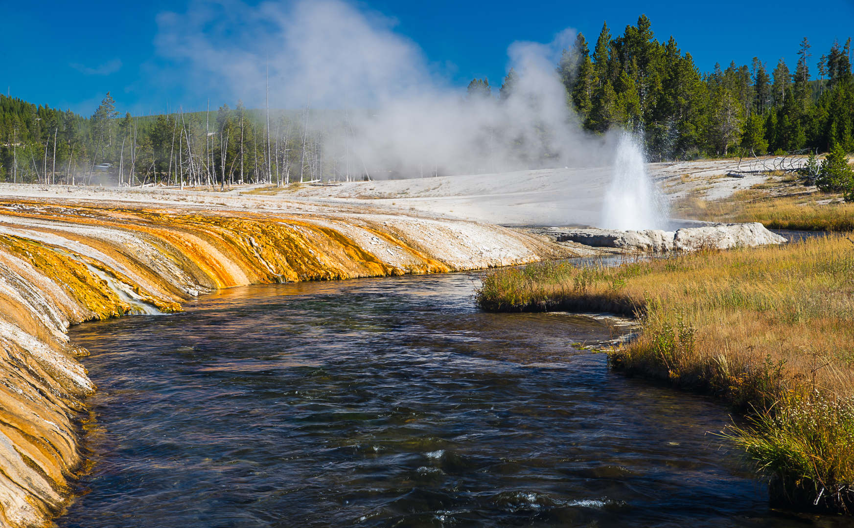
Rest of the day, we were in geyser heaven. We drove first to the Black Sand Basin. The isolated group of the Upper Geyser Basin, it was originally named the Emerald Group. But turn of the century tourists began calling it Black Sand Basin because of the small fragments of black obsidian sand which cover portions of the basin. The Sprouter Geyser next to the Parking Lot was active and I grabbed a shot of it.
Nikon D610 44mm f14 1/30 ISO100
(44.462800, -110.853083)
Cliff Geyser started acting. We walked to the bridge over the Iron Spring Creek and shot an image.
Nikon D610 75mm f16 1/15 ISO100
(44.461854, -110.854487)
Emerald Pool, an awesome looking hot spring named for its emerald green color, is one of the main attractions at Black Sand Basin. Its temperature is about 150°F and its dimensions are 27×38 feet with a depth of 25 feet. The color is due to growth of yellow bacteria and algae. Cooling, the result of objects thrown into the pool and natural debris, has affected the growth of the bacteria and algae, making the pool appear orange and brown around the edges.
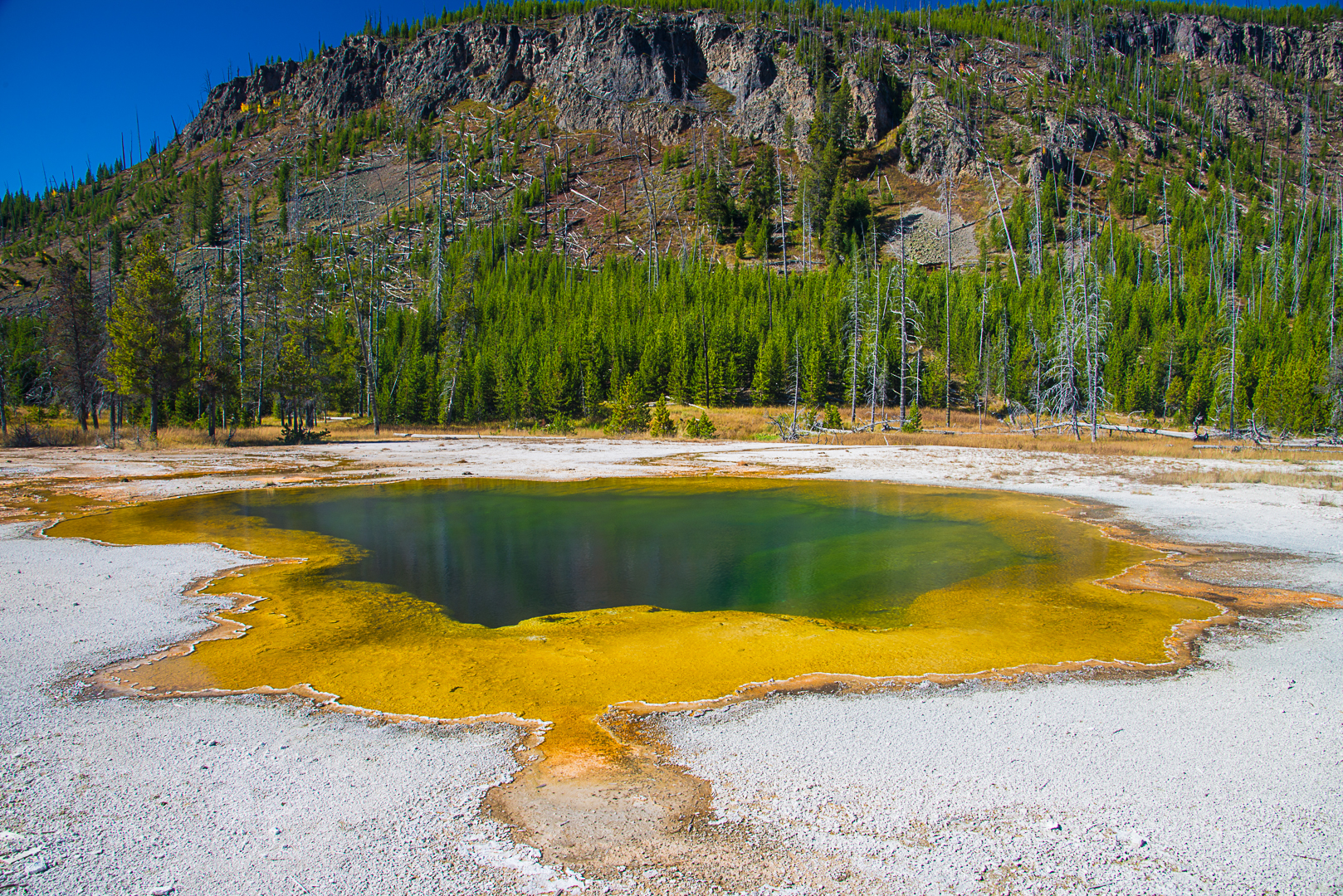
Nikon D610 24mm f13 1/20 ISO100
(44°27’40” N 110°51’19” W)
We grabbed a quick lunch and checked out the geyser schedules posted at the Visitor Center. Grand Geyser and the Castle Geyser were expected to erupt in the next 3 hours. We started walking towards the Grand Geyser. Along the way, we stopped by the Belgian pool to grab a shot.
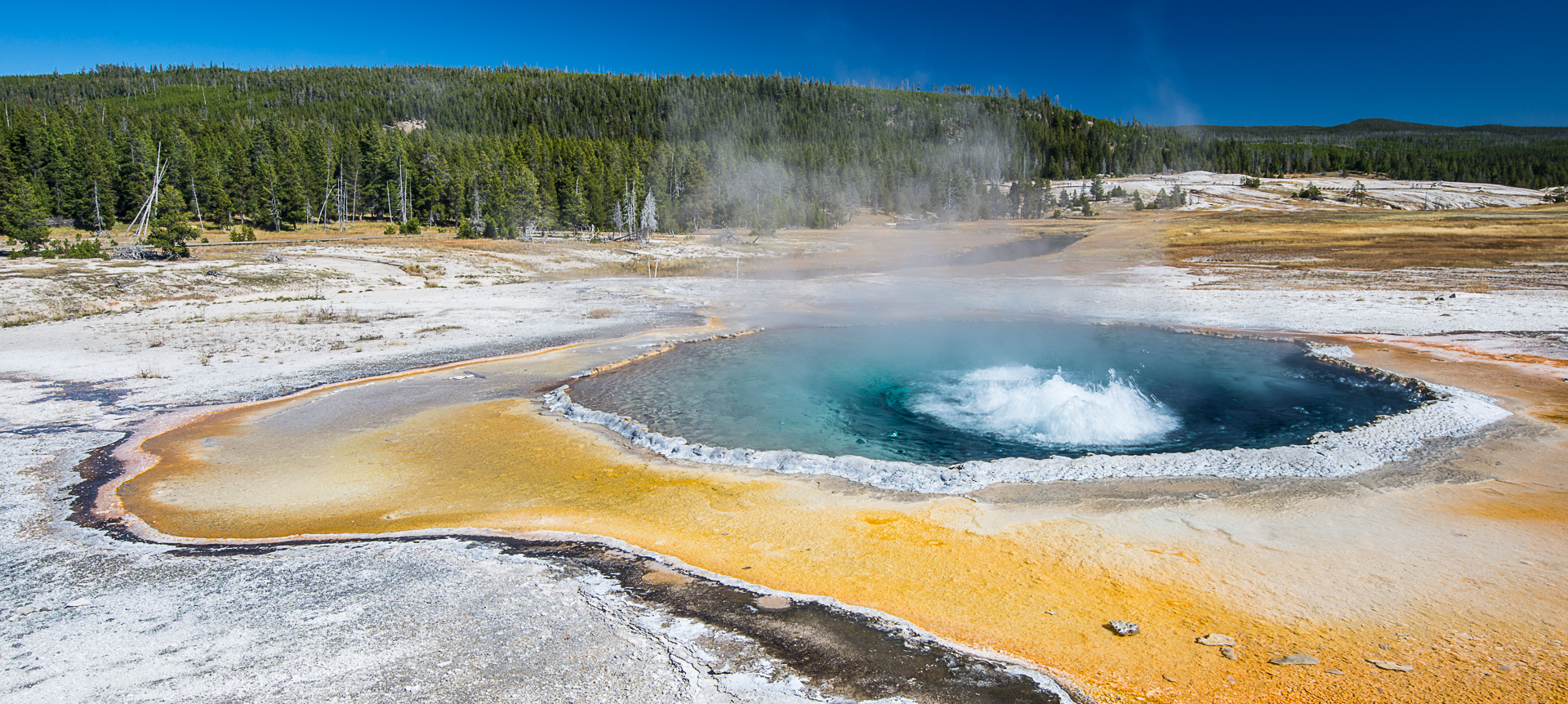
Nikon D610 22mm f13 1/25 ISO100
(44°27’58” N 110°50’12” W)
We sat in front of the Grand Geyser and the show started in the middle of the predicted window and it was grand indeed and lasted 10 or so minutes. There was a lot of spray and the UV-filter came handy.
Nikon D610 35mm f13 1/30 ISO100
(44°27’60” N 110°50’15” W)
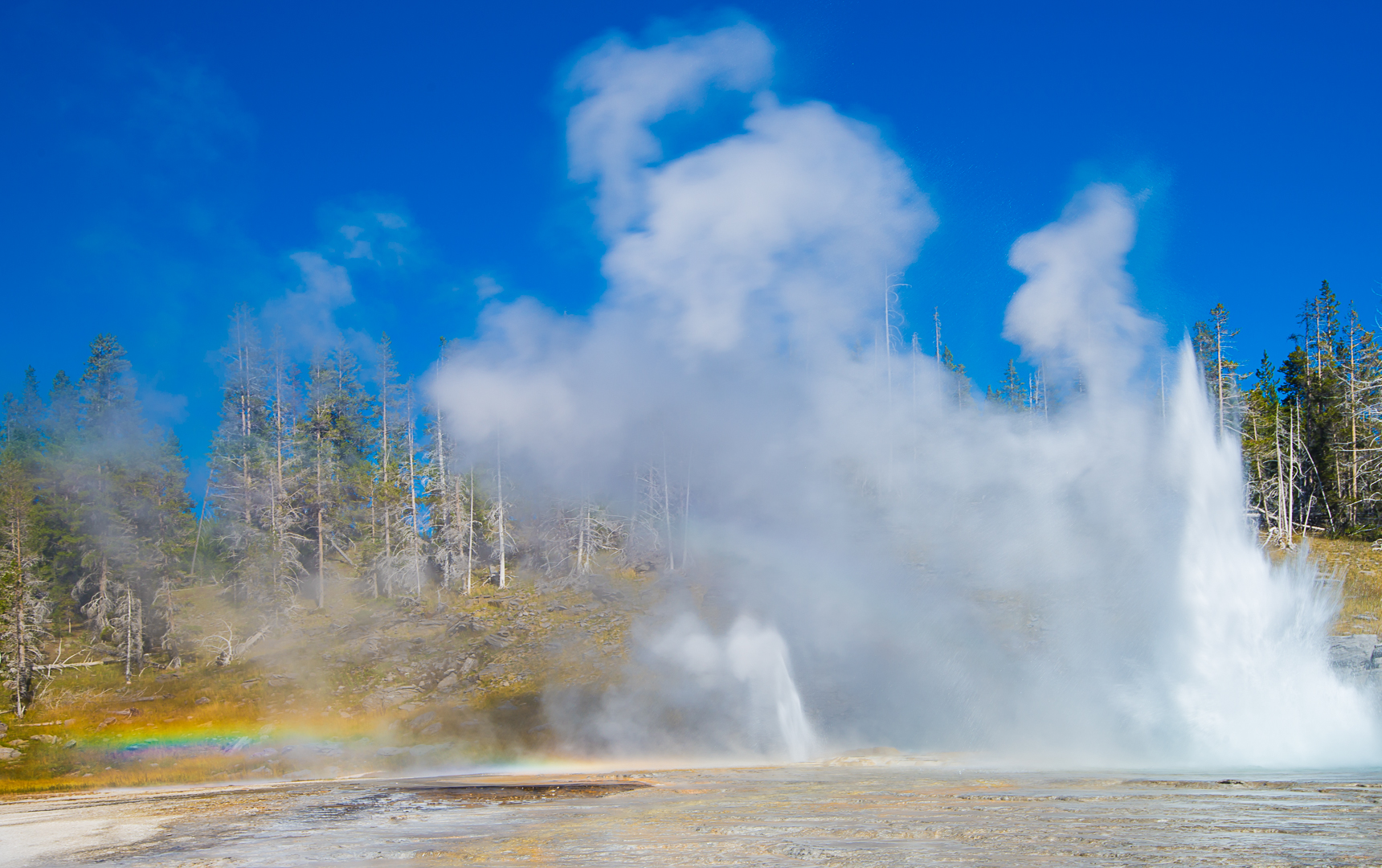
After the show, we walked to the Castle Geyser. This required a wait of over 90 minutes but it was well worth it. The eruption lasted 15+ minutes. I chose an angle to shoot the rainbow created by the spray.
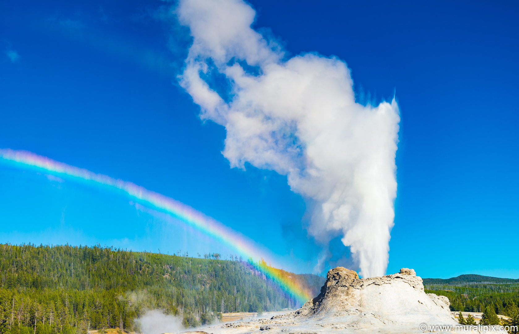
Nikon D610 44mm f11 1/60 ISO200
(44°27’49” N 110°50’13” W)
After the show, we walked on the boardwalk and came across a very colorful pool called the Liberty Pool.
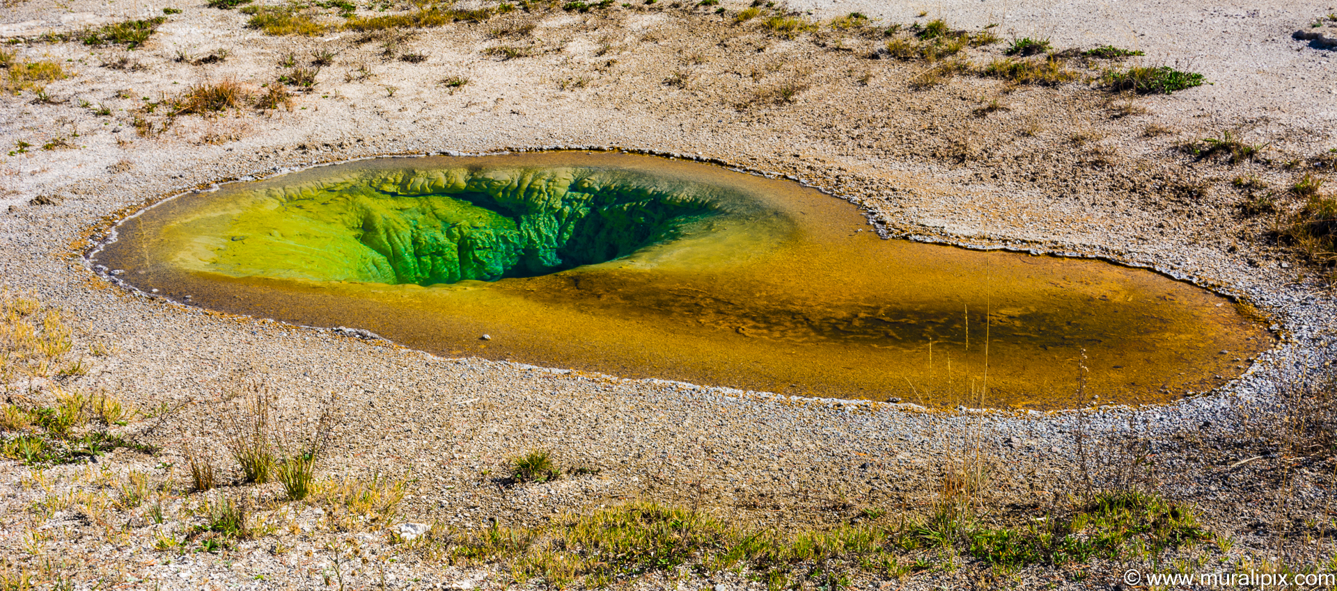
Nikon D7100 31mm f11 1/30 ISO100
(44°27’59” N 110°50’14” W)
While we were there, somebody yelled that the Beehive Geyer was erupting. The 4-foot (1.2 m) tall cone resembles a beehive. Eruptions of the geyser last about 5 minutes and are 200 feet high. The fountain maintains its full height for the duration of the eruption, dropping just slightly near the end. A roaring steam phase concludes the eruption and can be heard a quarter-mile away. The interval between eruptions range from 16-18 hours to one day. We did’nt have the time to run to the geyser and so I took a shot from near the Liberty Pool.
Nikon D7100 160mm f11 1/160 ISO800
(44°27’57” N 110°50’11” W)
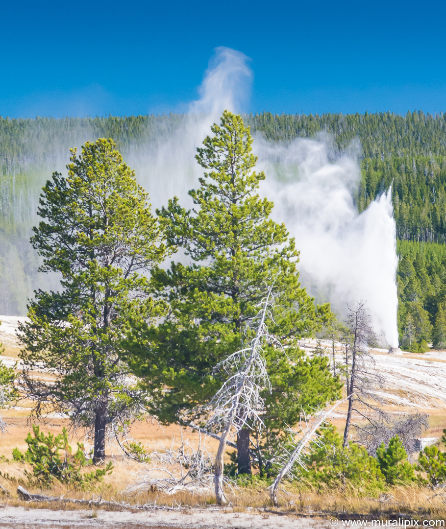
Old Faithful, the grand daddy of all the geysers is a cone geyser and was named in 1870 during the Washburn-Langford-Doane Expedition. It was the first geyser in the park to receive a name. It is a highly predictable geothermal feature; since 2000, it has erupted every 44 to 125 minutes. More than 1,000,000 eruptions have been recorded. It is not the tallest or largest geyser in the park; those titles belong to the less predictable Steamboat Geyser. The reliability of Old Faithful can be attributed to the fact that it is not connected to any other thermal features of the Upper Geyser Basin.
Eruptions can shoot 3,700 to 8,400 US gallons of boiling water to a height of 106 to 185 feet lasting from 1 1⁄2 to 5 minutes. The average height of an eruption is 145 feet. Intervals between eruptions can range from 35 to 120 minutes, averaging 66.5 minutes in 1939, slowly increasing to an average of 90 minutes apart today, which may be the result of earthquakes affecting subterranean water levels. The disruptions have made earlier mathematical relationships inaccurate, but have actually made Old Faithful more predictable in terms of its next eruption.
The time between eruptions has a bimodal distribution, with the mean interval being either 65 or 91 minutes, and is dependent on the length of the prior eruption. Within a margin of error of ±10 minutes, Old Faithful will erupt either 65 minutes after an eruption lasting less than 2 1⁄2 minutes, or 91 minutes after an eruption lasting more than 2 1⁄2 minutes.
When we reached the geyser, a small crowd was already gathered and the show was ready to start. The show was terrific.
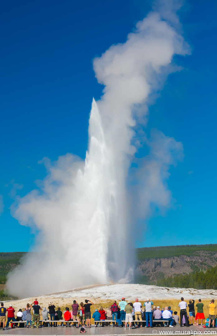
Nikon D610 65mm f16 1/160 ISO400
(44°27’35” N 110°49’44” W)
We then moved to the right side of the viewing area and took a few shots.
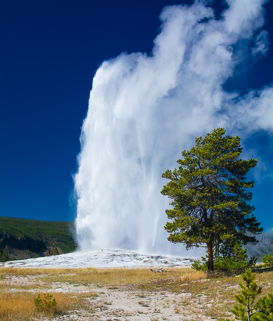
Nikon D7100 38mm f11 1/160 ISO320
(44°27’37” N 110°49’36” W)
We then drove back to the Yellowstone Lodge, dumped our camera equipment, took a quick shower and went to the restaurant at the Inn for dinner.
Day 8 – Sep 26 (Upper Geyser Basin to Mammoth Hot Springs)
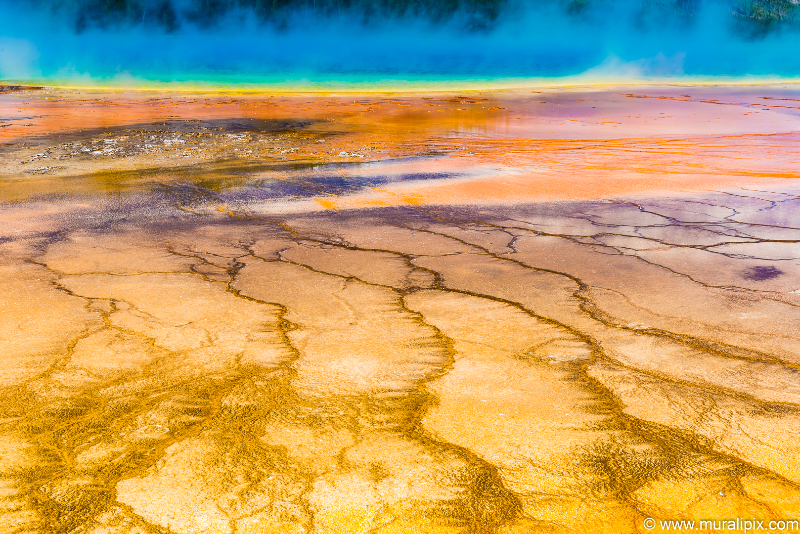
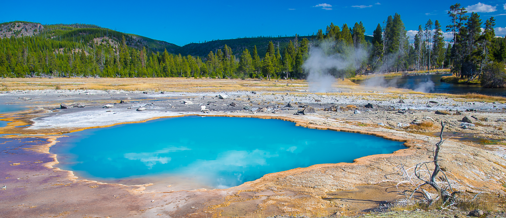
After breakfast, we checked out and drove to the Midway Geyser Basin. After parking the car, we headed straight to the famous Grand Prismatic Spring, the largest hot spring in the United States, and the third largest in the world. The vivid colors in the spring are the result of microbial mats around the edges of the mineral-rich water. The mats produce colors ranging from green to red; the amount of color in the microbial mats depends on the ratio of chlorophyll to carotenoids and on the temperature gradient in the runoff. In the summer, the mats tend to be orange and red, whereas in the winter the mats are usually dark green. The center of the pool is sterile due to extreme heat.
The deep blue color of the water in the center of the pool results from the scattering of blue light by particles suspended in the water. This effect is particularly visible in the center of the spring due to the lack of archaea that live in the center and to the depth of the water.
The best spot to photograph the Spring is from the overlook on the hill to the south but unfortunately, we didn’t have the time. The second best option was to shoot it up close.
Nikon D610 48mm f11 1/10 ISO100
(44°31’32” N 110°50’16” W)
On our way back, we checked out the nearby colorful Opal Pool and the Turquoise Pool.
Nikon D610 35mm f14 1/40 ISO200
(44°31’36” N 110°50’19” W)
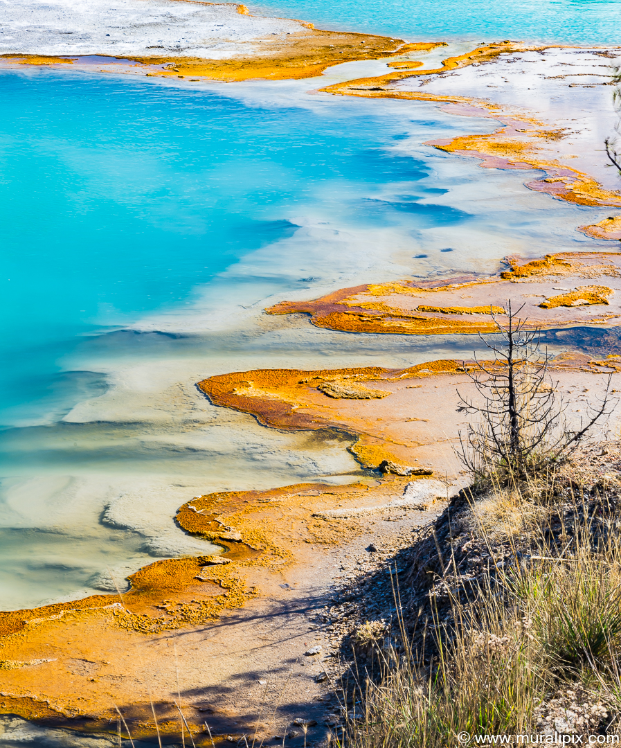
Nikon D610 85mm f16 1/8 ISO100
(44°31’35” N 110°50’16” W)
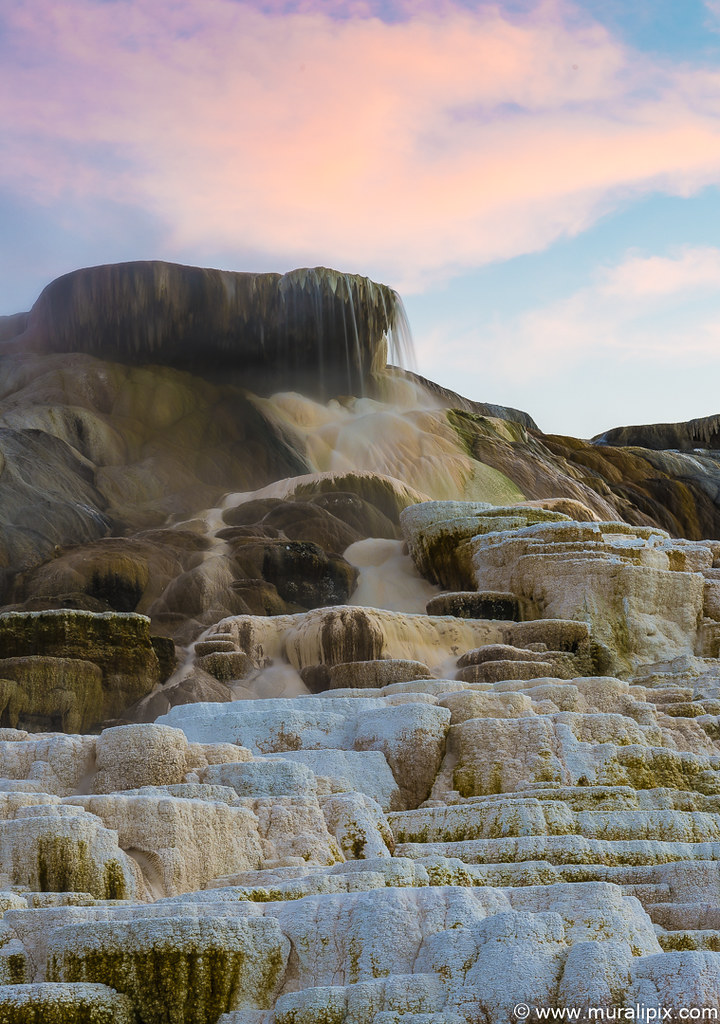
We drove back to Mammoth Hot Springs for the last night of the trip. It is a large complex of hot springs on a hill of travertine. It was created over thousands of years as hot water from the spring cooled and deposited calcium carbonate (over two tons flow into Mammoth each day in a solution). Because of the huge amount of geothermal vents, travertine flourishes. Although these springs lie outside the caldera boundary, their energy has been attributed to the same magmatic system that fuels other Yellowstone geothermal areas. We first drove around the Upper Terrace Loop and checked out the Orange Spring Mound.
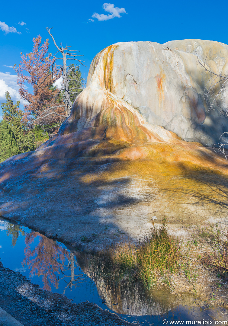
Nikon D610 38mm f11 1/125 ISO400
(44°57’59” N 110°42’55” W)
We decided to go back to shoot the Palette Springs and Devil’s Thumb in the evening light. The lighting was perfect.
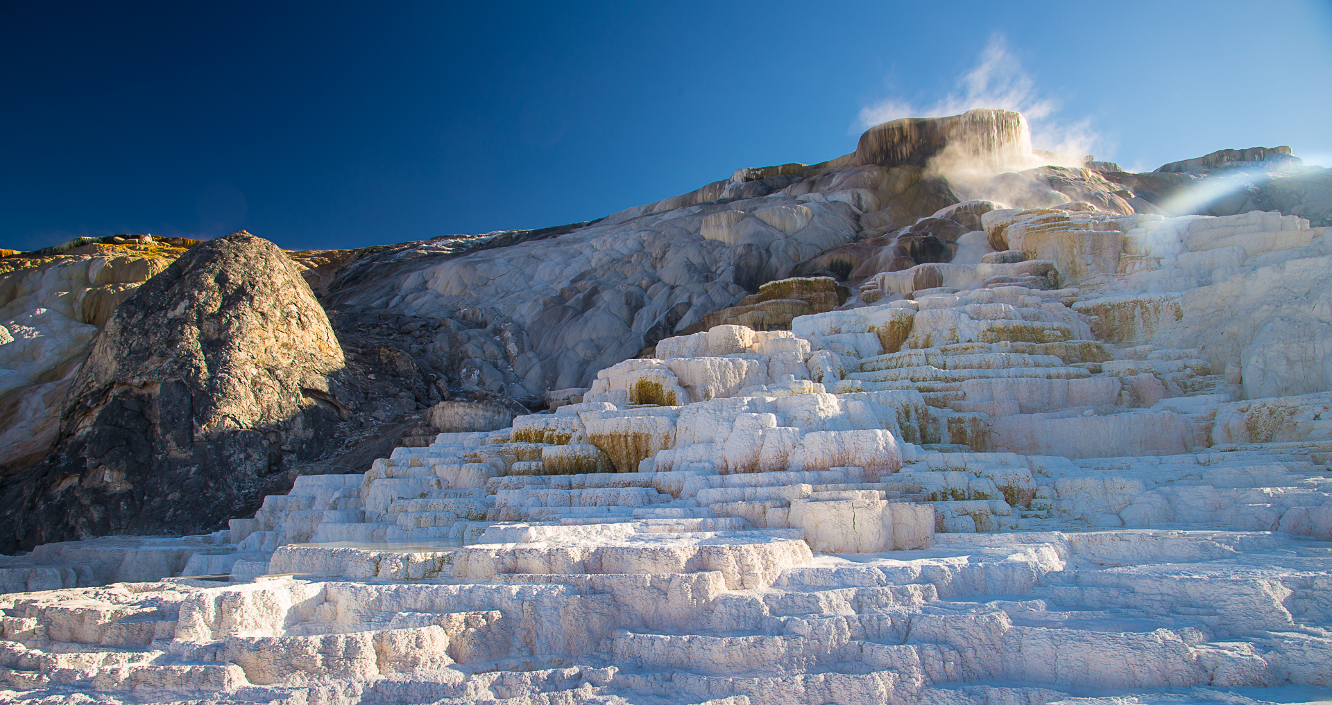
Nikon D610 24mm f11 1/25 ISO100
(44.972631, -110.705250)
On the 27th morning, we returned to Seattle via Bozeman, MT.

6 responses to “Yellowstone and Grand Teton NP (Sep 2014)”
Gorgeous, absolut outstanding travel photostory! You make want to pack my bags and go right away – and learn photography from you as well! 🙂
Wishing you a wonderful Sunday and the best of all summers!
Warm greetings from Norway,
The Fab Four of Cley
LikeLike
Thanks Dina for your kind words. Norway is an awesome country and we totally enjoyed our time there. A bit expensive though 🙂
LikeLiked by 1 person
Much too expensive for my liking. I live abroad and can hardly afford to visit. 😉
LikeLike
Fantastic, most extraordinary !
LikeLike
Thanks a bunch!!!
LikeLike
Wow, incredible blog layout! How long have you been blogging for? you made blogging look easy. The overall look of your web site is magnificent, as well as the content!
LikeLike