Earlier this week, Mythili and I took a 2-day trip to the northern Olympic peninsula. The main goal of the short trip was to check out the Sol Doc Falls that has been in my bucket list for over a decade. As the weather forecast was for cloudy skies and a few drizzles, we jumped on the opportunity. On the way, we also did a short hike to two other waterfalls – Ludlow Falls in Port Ludlow and the Madison Creek Falls just outside the town of Port Angeles. We also spent a few hours at Port Townsend to photograph the Point Wilson Lighthouse located in the Fort Worden State Park.

Day 1 (May 16, 2022)
We left home at 6am to catch the 7:10am Edmonds-Kingston Ferry. As it was a Monday, there wasn’t much traffic. The ferry left on time. Our first stop was at the Ludlow Falls. It was a bit of a challenge to locate the trailhead to the falls even though we had the GPS coordinates. A local gave us clear directions and we reached the trailhead. Tip: When you are going west on Oak Bay Rd, turn left on Breakers Lane, make a right in front of the Kitsap Bank and the trailhead is at the end of the street.
Ludlow Falls
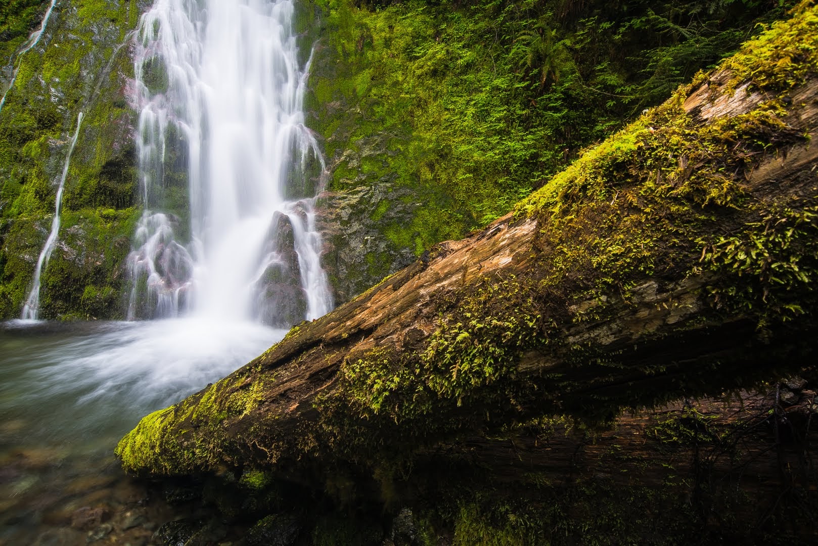
We walked the 0.5-mile loop trail. We encountered just one person who runs around the loop 6 times every day for his morning exercise. The fastest way to the falls is to do the loop in the anti-clockwise direction. The falls drop a total of 33 feet in a series of cascades which start with a set of small cascades which pour into potholes, then a stretch of stream which sheets across a smooth exposure of bedrock, and finally a steeper veiling cascade which finishes off the falls. There were several logs fallen over the middle of the falls, as well as an ever-growing logjam at the bottom of the falls which clutters the view and makes the waterfall more difficult to photograph. The falls was not terribly impressive. It started to rain and I had to cover my equipment with a cloth to protect it.

Nikon D750 35mm f8 1 sec ISO 100
Nikon D810 55mm f9 1.6 sec ISO 200
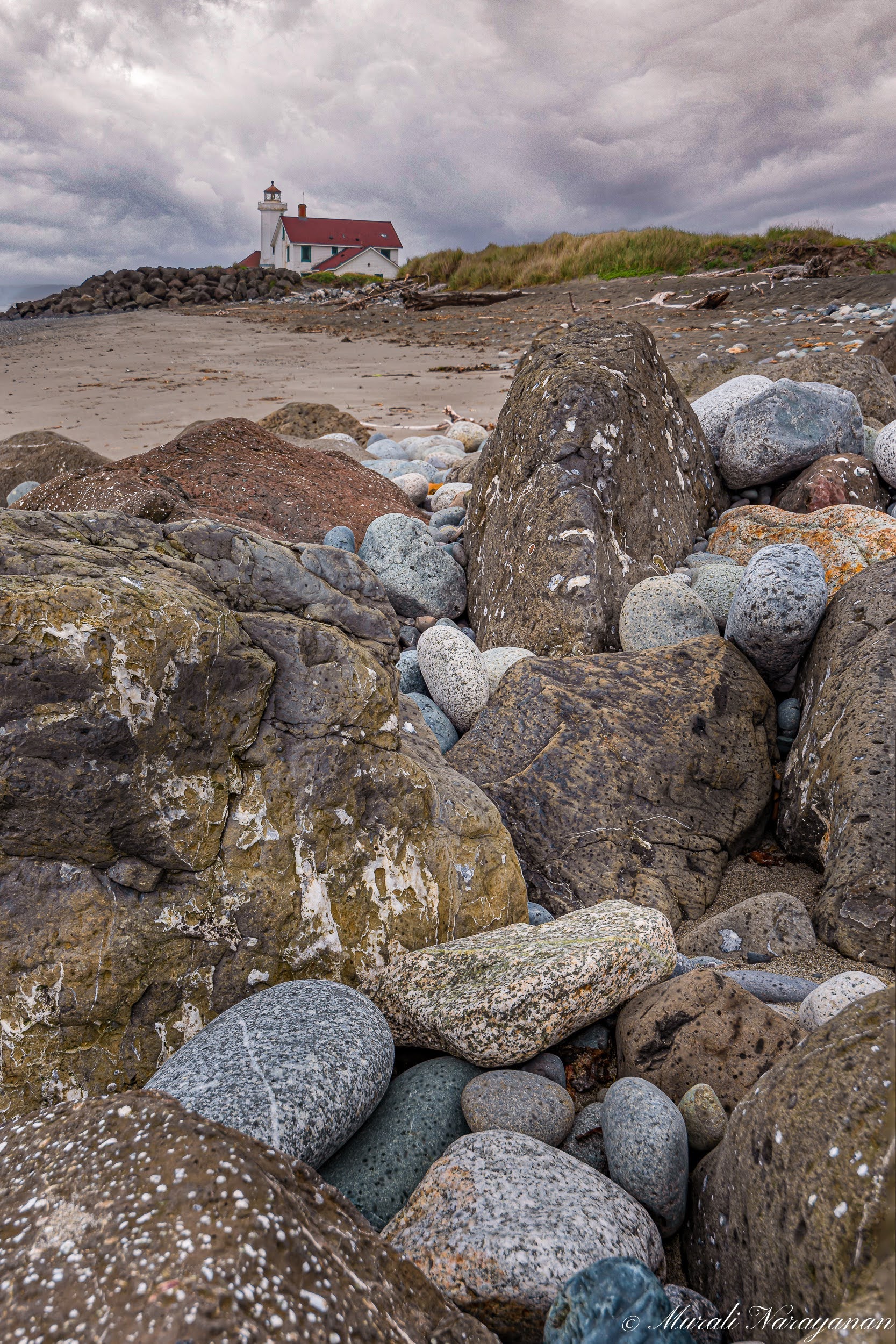
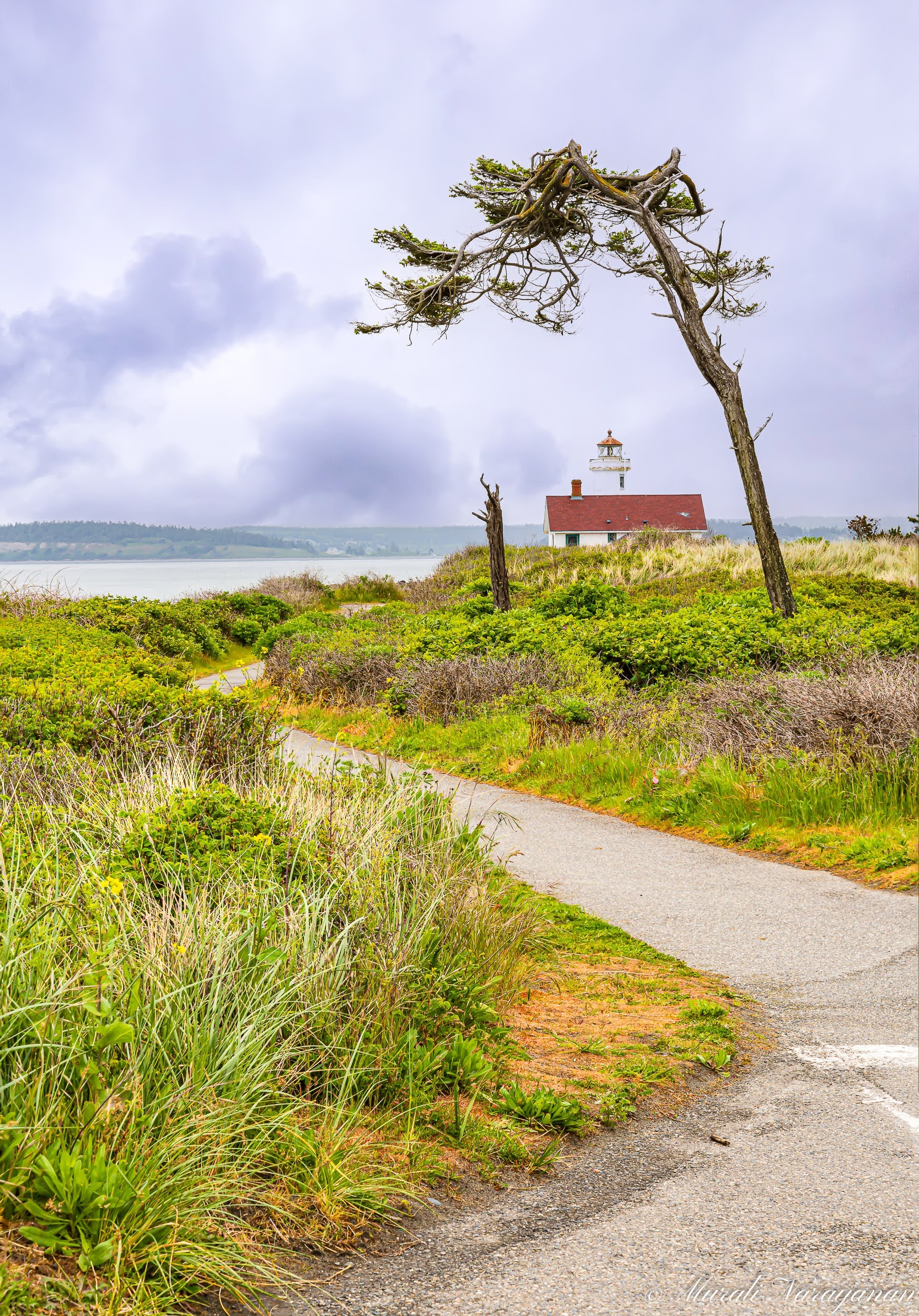
Point Wilson Lighthouse
The next stop was at the Point Wilson Lighthouse which is located inside Fort Worden State Park. On the way, we took a short detour to see the state of lavender fields at the Purple Haze Organic Lavender Farm. It was too early for lavender blooms. Mid July is a better time when the lavender festival will be at its epoch.
We reached Port Townsend at around 10. The lighthouse is one of the most important navigational aids in the state, overlooking the entrance to Admiralty Inlet, the waterway connecting the Strait of Juan de Fuca and Puget Sound. Completed in 1914, it was built of reinforced concrete with a 46-foot octagonal tower designed to withstand the wind. The area surrounding the lighthouse is under serious threat from shoreline erosion and rising sea levels. US Coast Guard has placed a large number of boulders around it for protection. Fort Worden State Park and Point Wilson Lighthouse provided the perfect background for the movie, An Officer and a Gentleman filmed in the early 80s.
It was a very cloudy day with a little bit of drizzle. There was not much of a crowd at the beach. We spent about 1.5 hrs photographing the lighthouse and the surrounding landscapes.
Nikon D750 35mm f10 1/80sec 100 ISO (4-image focus stack)
Nikon D810 85mm f9 1/40 sec ISO 64 (3 image Focus Stack)
We left the park at quarter to noon and drove to Madison Creek Falls just outside the town of Port Angeles. It was close to 1 when we reached the falls. It was a very short hike to the falls from the parking lot. We were surprised that the parking lot was mostly full considering it was a Monday in May. We had lunch at the falls. As it was quite slippery, I decided not to climb down to the base of the falls.
Nikon D750 20mm f16 1sec ISO 100
We reached our hotel at around 3pm and checked in. Light was harsh as the clouds had dissipated. At 4, we drove around Ediz Hook, which is a three mile long natural spit that features incredible views of the Olympic Mountains, and the Strait of Juan de Fuca. We searched for bald eagles but unfortunately we didn’t find any but there were lots of gulls.
Day 2 (May 17, 2022)
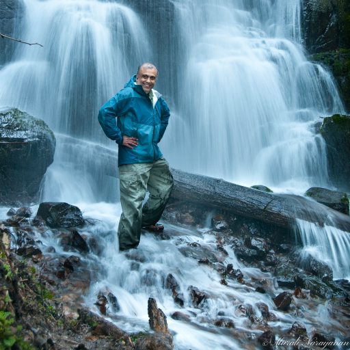
Sol Duc Falls & Trail
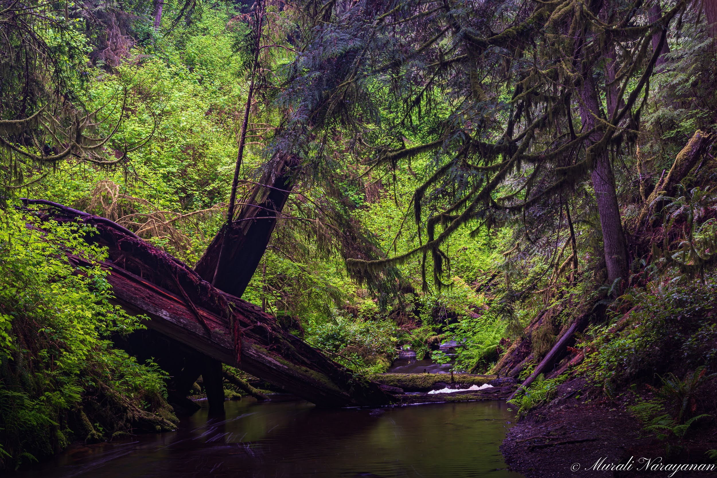
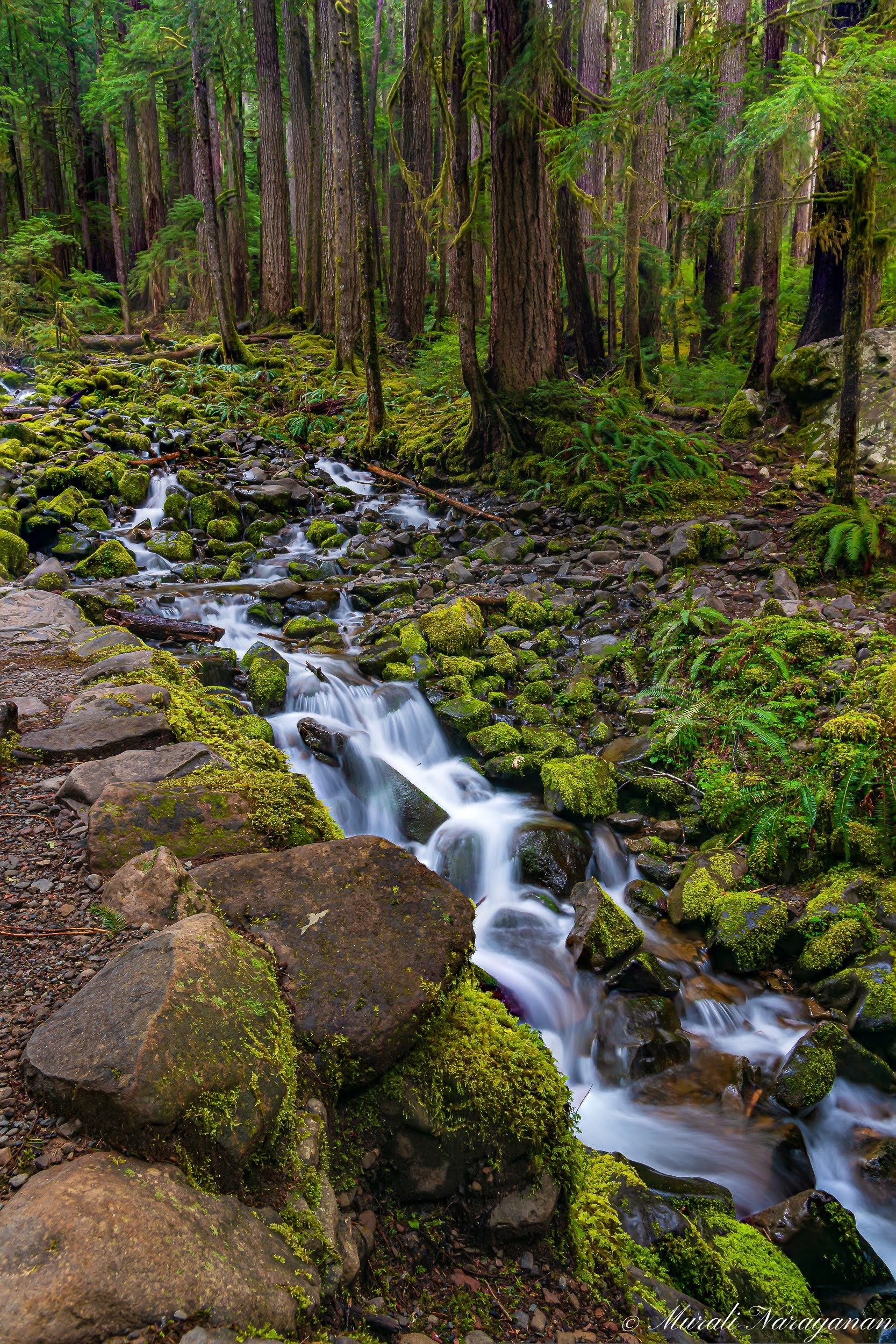
We got up at 4am, had early breakfast and drove to the Sol Duc Falls and parked the car at the Falls Trailhead parking lot at a bit before 7. There were just 5 cars at the lot. We started the 0.8m hike at 7. The trail is family friendly and pleasant, wandering beneath a dense forest canopy and among every shade of green. We crossed two small creeks, pausing to enjoy the water tumbling over moss-covered rocks. Sol Duc Falls announces itself with a roar prior to coming into view. At 0.8 mile we arrived at a historic shelter and waterfall. The falls is very impressive and it is no wonder one of Olympic National Park’s most beloved attractions. It is by most accounts one of the most photogenic waterfalls in Washington State and by proxy is one of the most sought out waterfalls by photographers. It has been in my Pacific Northwest waterfalls bucket list for close to 15 years. The Sol Duc River creates one of the more uniquely shaped waterfalls in the northwest where it splits into as many as four channels – depending on the volume of the river – hurtling 37 feet off the side of a cliff into a narrow canyon. The National Park Service has done an excellent job at constructing rustic viewpoints that provide many varied angles of perspective.

Nikon D750 28mm f11 1/3 Sec 100 ISO)
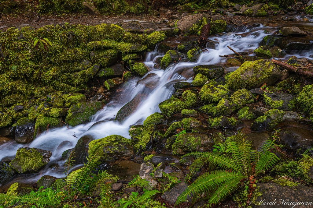
After spending an hour, we stopped at a beautiful creek to photograph the flowing water and the moss covered rocks. We spent more time here than at the falls as there were too many angles to shoot from. Also, the SD card in my D810 died and so I had to reshoot some of the shots. Luckily, I could recover the images on the card after I returned home.

Nikon D810 23mm f11 0.6 sec ISO 200
Nikon D750 24mm f8 1.3 sec ISO 100
It was close to 11 by the time we finished the hike. We decided to go back to Point Wilson Lighthouse to reshoot some of the images I thought I had lost due to the SD card failure. We picked up lunch at a Subway in Port Angeles and reached the lighthouse at 1. It was quite crowded. Luckily we located a parking spot and had lunch at the beach. I then spent an hour re-shooting the “supposedly lost images”. At 2:30pm, we decided to get back home as the Kingston-Edmonds Ferry was scheduled to leave at 4pm and it was about an hour’s drive to the Kingston Ferry terminal from the lighthouse.
We reached the Kingston Ferry terminal at 3:30pm and the ferry left right on time. We reached home at 5:15pm. Total driving distance over the two days turned out to be about 375 miles.

One response to “Northern Olympic Peninsula”
Mu a nice, detailed travelogue that embellishes the beautiful photos. I have just crossed these off my bucket list- no need to visit them, as it is like having had a ring side seat all along 😀
LikeLiked by 1 person