This post is Part 3 of the 1200-mile journey across Oregon, exploring the Painted Hills unit of the John Day Fossil Beds National Monument near Mitchell, OR. You can find Part 1 here and Part 2 here.
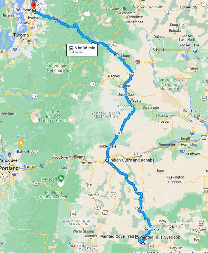
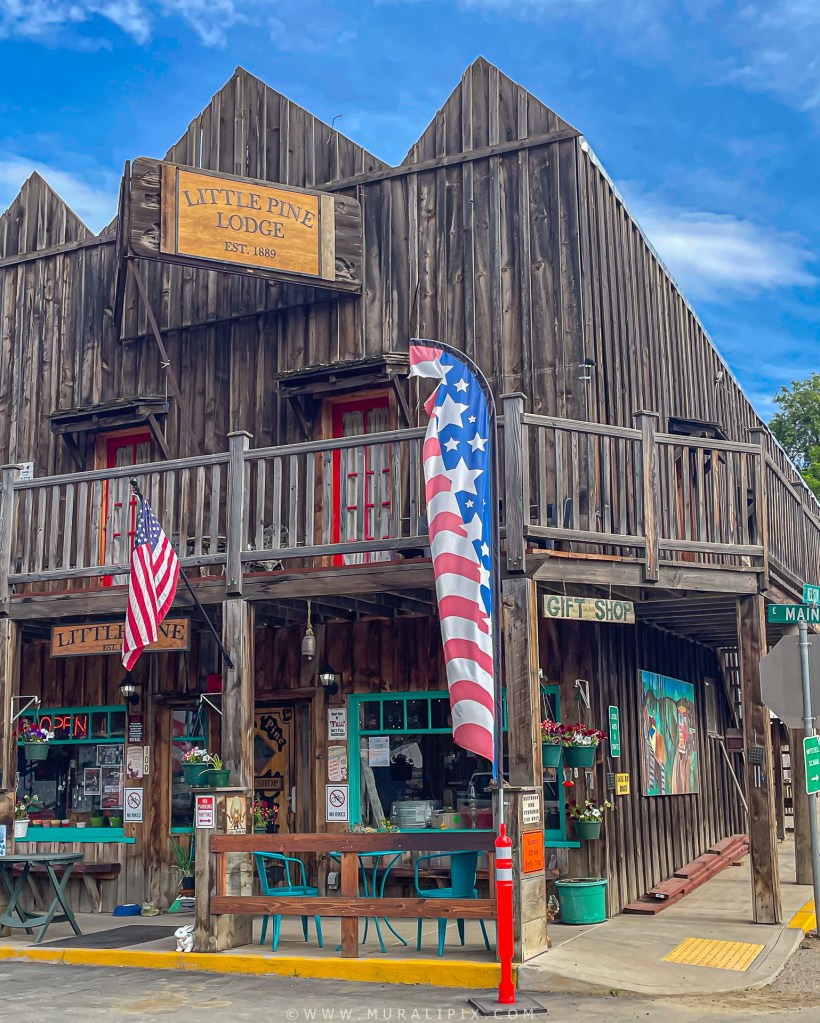
On June 16, our journey led us to our final destination, Mitchell, OR, at around 4 pm. This quaint town, home to approximately 175 residents, serves as the gateway to the captivating Painted Hills unit of the renowned John Day Fossil Beds National Monument. Our accommodation for the stay was the delightful Little Pine Lodge, a charming 3-bedroom Airbnb located on the second floor of a century-old building. With its historic charm and 1650 square feet of space, the lodge exuded absolute allure. Additionally, its prime location allowed us the convenience of strolling to Tiger Town Brewing Co, one of the town’s two charming restaurants, providing a delightful dining experience within walking distance.
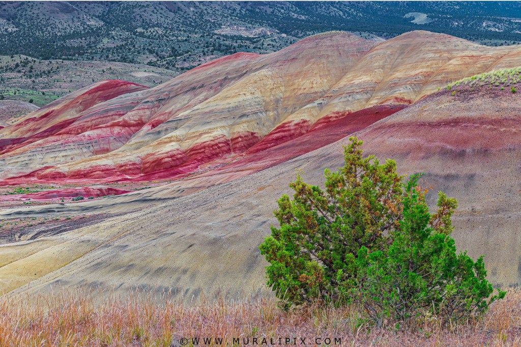
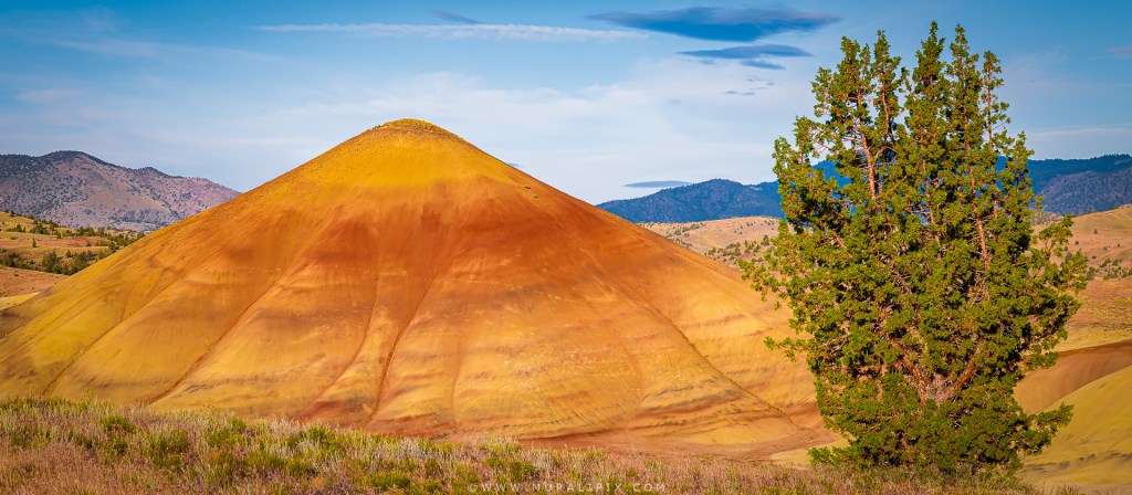
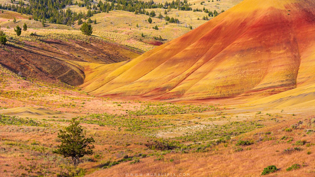
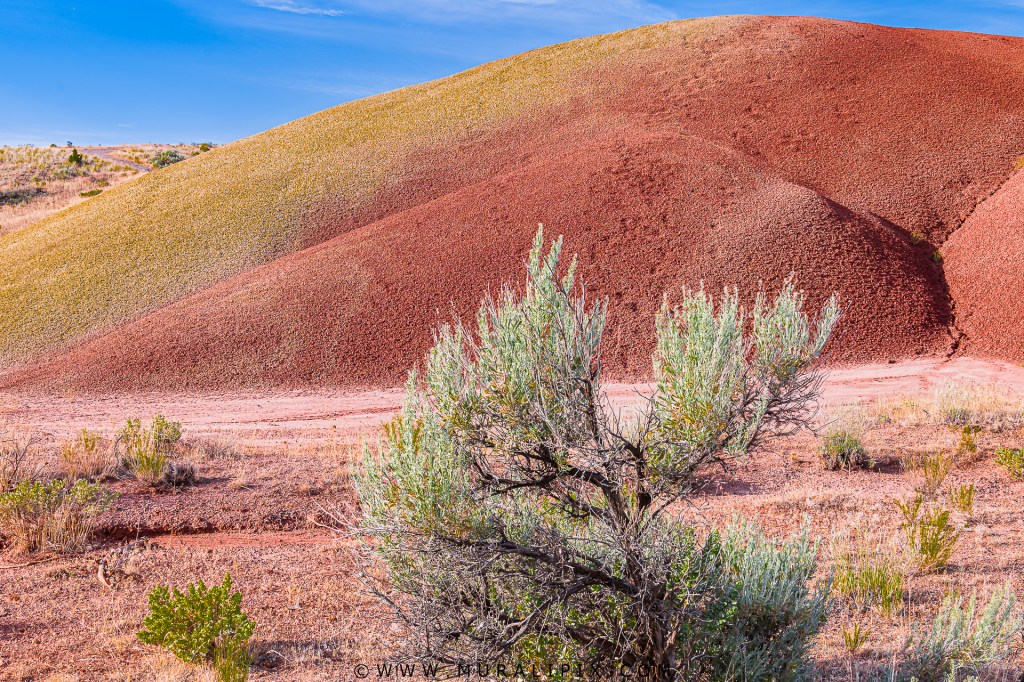
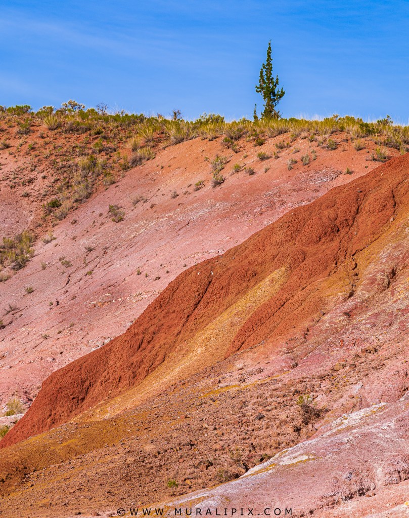
The Painted Hills stand as a mesmerizing natural wonder. These vibrant hills, characterized by their stunning array of colorful layers, create a picturesque landscape that appears as though an artist’s brush has gently swept across the terrain. The hills showcase hues of red, gold, black, and even purple, forming a breathtaking mosaic of earthy tones.
The Painted Hills started to appear about 35 million years ago. This happened when ash and tiny pieces of rock from volcanoes in the Cascade Mountains traveled about 100 miles and settled in that area. Once there, the ash and other sediments were mixed by natural processes including the flow of water, growth of plants, and the movement of animals. Over time, this led to oxidation of the ash on the surface.
The colors of the Painted Hills come from the combination of elements including Aluminum, Silicon, Iron, Magnesium, Manganese, Sodium, Calcium, Phosphorus, Titanium, Potassium, Oxygen, and Hydrogen, among others, which arrived with the initial ash fall. Originally light in color, the ash mixed with soils and other elements to form the minerals that give the hills colors such as red, yellow, and black.
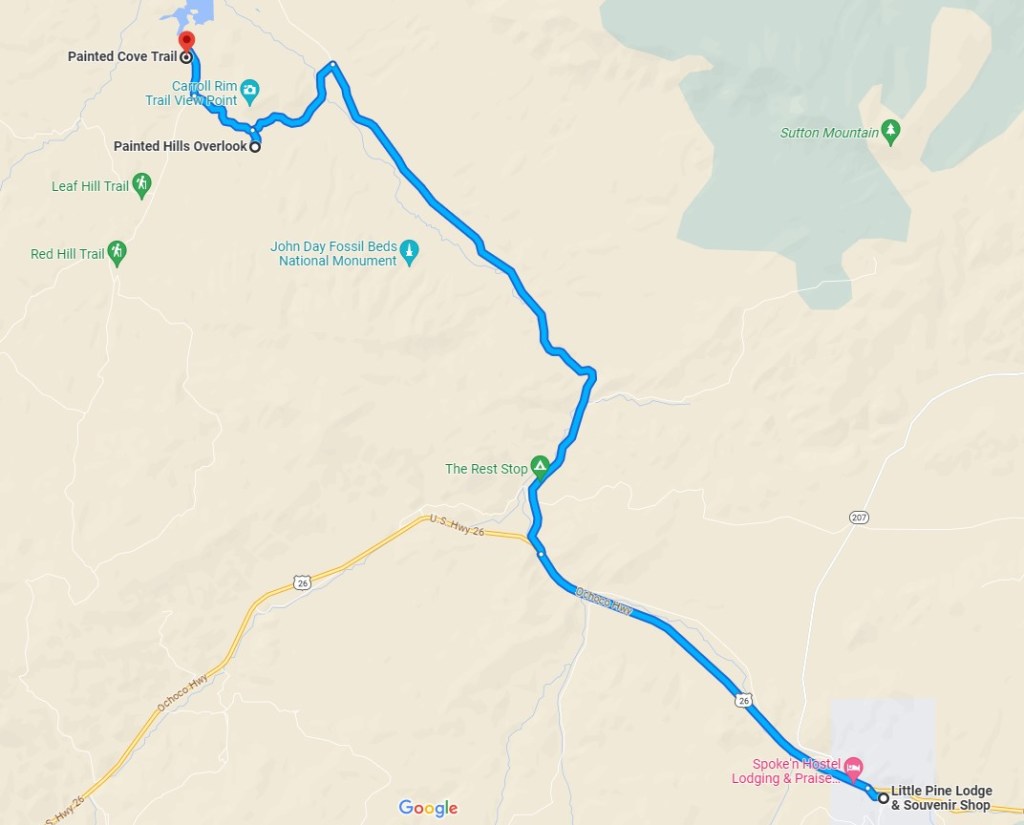
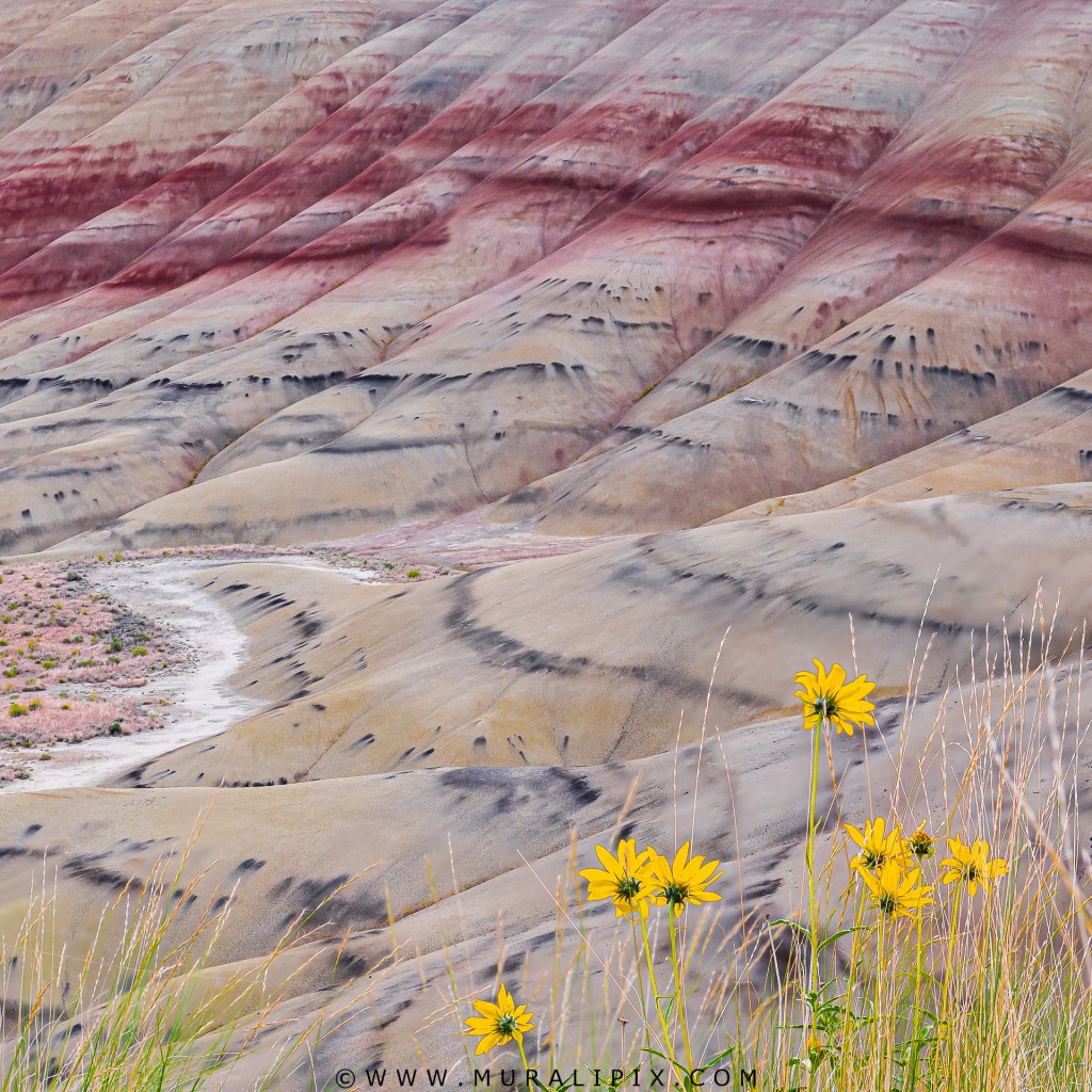
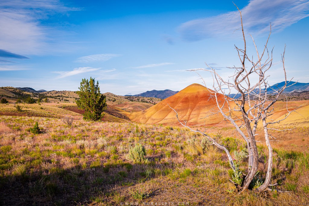
We visited two areas of the Painted Hills, Painted Hills Overlook and Painted Cove for sunset and the sunrise the next early morning. At the Overlook, we walked the 0.6-mile out-and-back trail with an elevation change of just about 75′. There were colorful hills on both sides of the trail and offered opportunities at both sunset and sunrise. Here are some images I captured along the trail.

Nikon D780 40mm f8 1/50 sec ISO 400 (3-image Focus Stack)
Nikon D780 66mm f8 1/60 sec ISO 400 (3-image Focus Stack)
Nikon D780 70mm f8 1/80 sec ISO 800 (4-image Focus Stack)
Nikon D780 75mm f8 1/80 sec ISO 100 (3-image Focus Stack)
Nikon D780 48mm f8 1/50 sec ISO 100 (3-image Focus Stack)
Nikon D7100 100mm f8 1/500 sec ISO 400 (3-image Focus Stack)
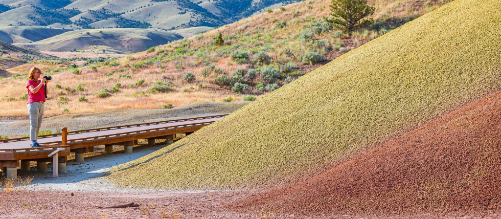
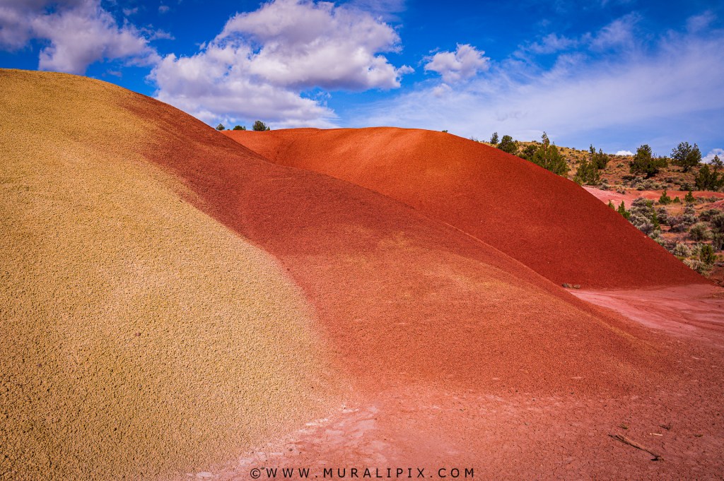
Painted Cove trail experience was different. Unlike the Overlook trail where the hills are farther away, the Painted Cove trail is closer to the smaller hills. In fact, you can even touch the rocks. It is a 0.3 miles loop trail with an elevation change of 40′. Part of the trail is a boardwalk. Following are some images I captured along the trail.
Nikon D780 85mm f9 1/80 sec ISO 100)
Nikon D780 30mm f9 1/200 sec ISO 100 (3-image Focus Stack)
Nikon D780 120mm f11 1/100 sec ISO 100
On our way back to the lodge, we stopped at a spot near the entrance to the Overlook trail to see if there were any wildflowers. The bloom had a few more weeks to peak. I ended up capturing the image shown below:

Nikon D7100 85mm f6.3 1/400 sec ISO 400 (3-image Focus Stack)
As the sunlight got harsh at around 9am, we packed up and returned to the lodge. We checked out at around 1030am started to drive back home, about 330 miles away. The drive back was beautiful. The hills, valleys, and the surrounding agricultural lands reminded me of the Palouse in Washington. There are a number of interesting spots along the road worthy of stop-and-shoot.
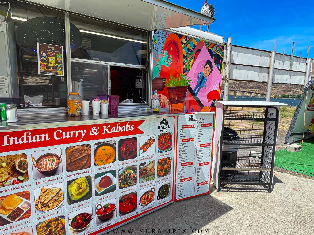
At noon we reached the small town of Briggs Junction on the banks of the mighty Colombia river separating Oregon from Washington. As the Subway restaurant inside the convenient store attached to a huge truck stop was closed, we identified an Indian Food truck adjacent to it. The area is super windy. No wonder there are hundreds of windmill-based power generators have been installed nearby. The food was excellent and exceeded my expectations. We ate the lunch inside a makeshift tent and enjoying the wind traversing the Colombia river.
After lunch, we jumped back on US 97 and entered Washington State crossing the Colombia river via Sam Hill Memorial Bridge. We passed Yakima and Ellensburg to arrive at Bellevue at around 445pm.

2 responses to “Central Oregon & Crater Lake Trip (Jun 12-17, 2023) Part 3”
Mu your travelogues are a delight for tired eyes. Your comments help contextualise the place and help us vicariouslytravel in a chauffeur driven car with u. Keep them coming
LikeLiked by 1 person
Absolutely stunning – never knew or seen anything like this before !
LikeLike